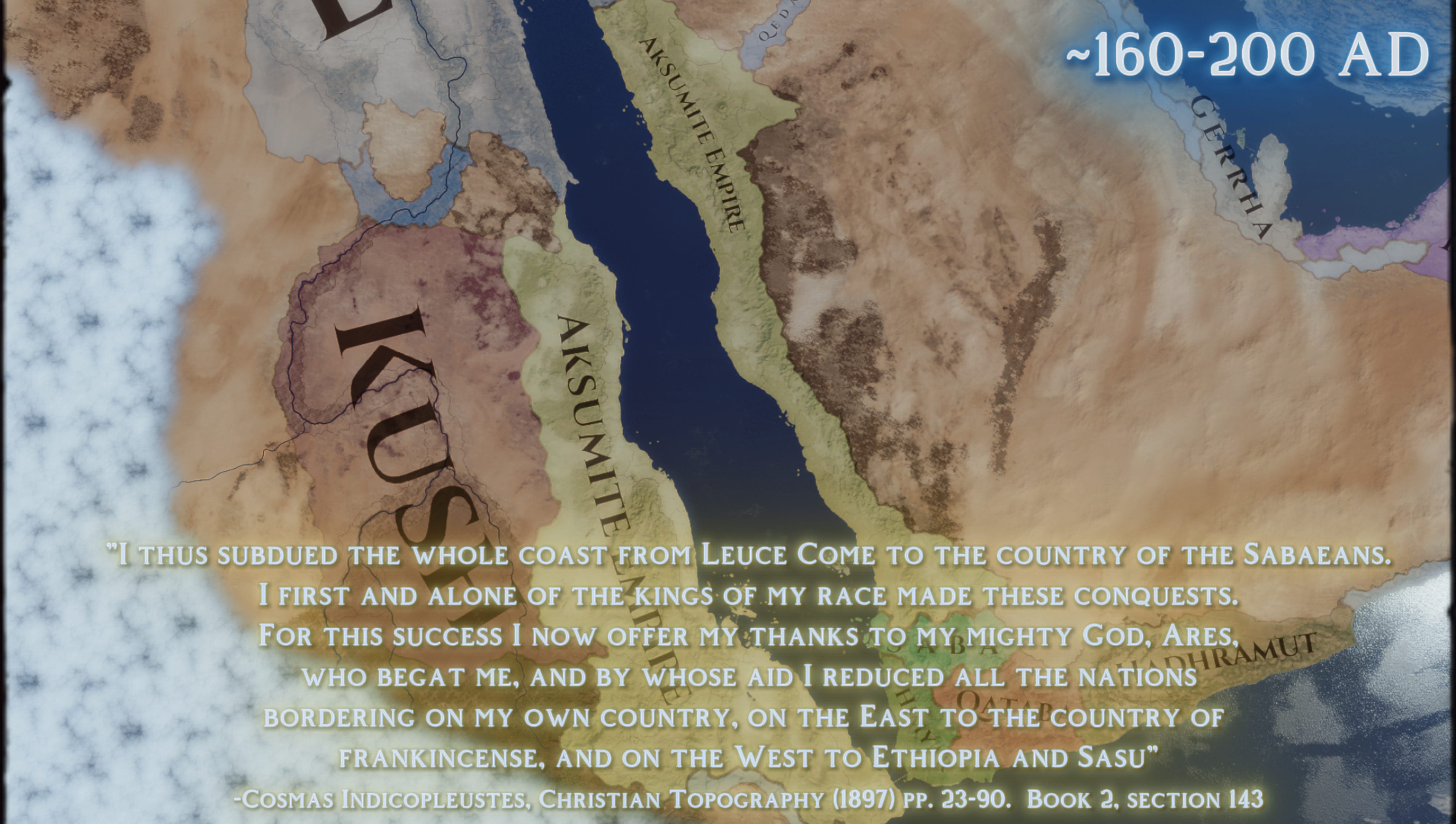
The Conqueror of the Adulis Throne (Monumentum Adulitanum II)
In the 2nd century AD, a powerful warrior from the northern highlands of Eritrea and Ethiopia forged an empire that stretched across both sides of the Red Sea. His name is lost, but his story isn't.
Map illustrating the conquests described in the Monumentum Adulitanum II (Inscription on the Throne of Adulis). Own Work.
Date Created: 8/20/2025
Last Updated: 8/26/2025
The absence of definitive evidence confirming whether the emperor referenced in Monumentum Adulitanum II hailed from Adulis or Aksum has led scholars to propose varying hypotheses. As such, there is no single “correct” answer. Beyond modern-day displays of point-scoring (which ultimately hold little significance), the fact remains that this leader emerged from the highland region of present-day Eritrea and Ethiopia. He placed considerable importance on the city of Adulis and played an important role in shaping the history of the Aksumite Empire and, by extension, that of both Eritrea & Ethiopia - Authors Disclaimer.
I encourage you to read the article and explore additional sources to form your own conclusions. Hopefully, future discoveries of artefacts and primary sources will help shed further light on these questions.
Introduction
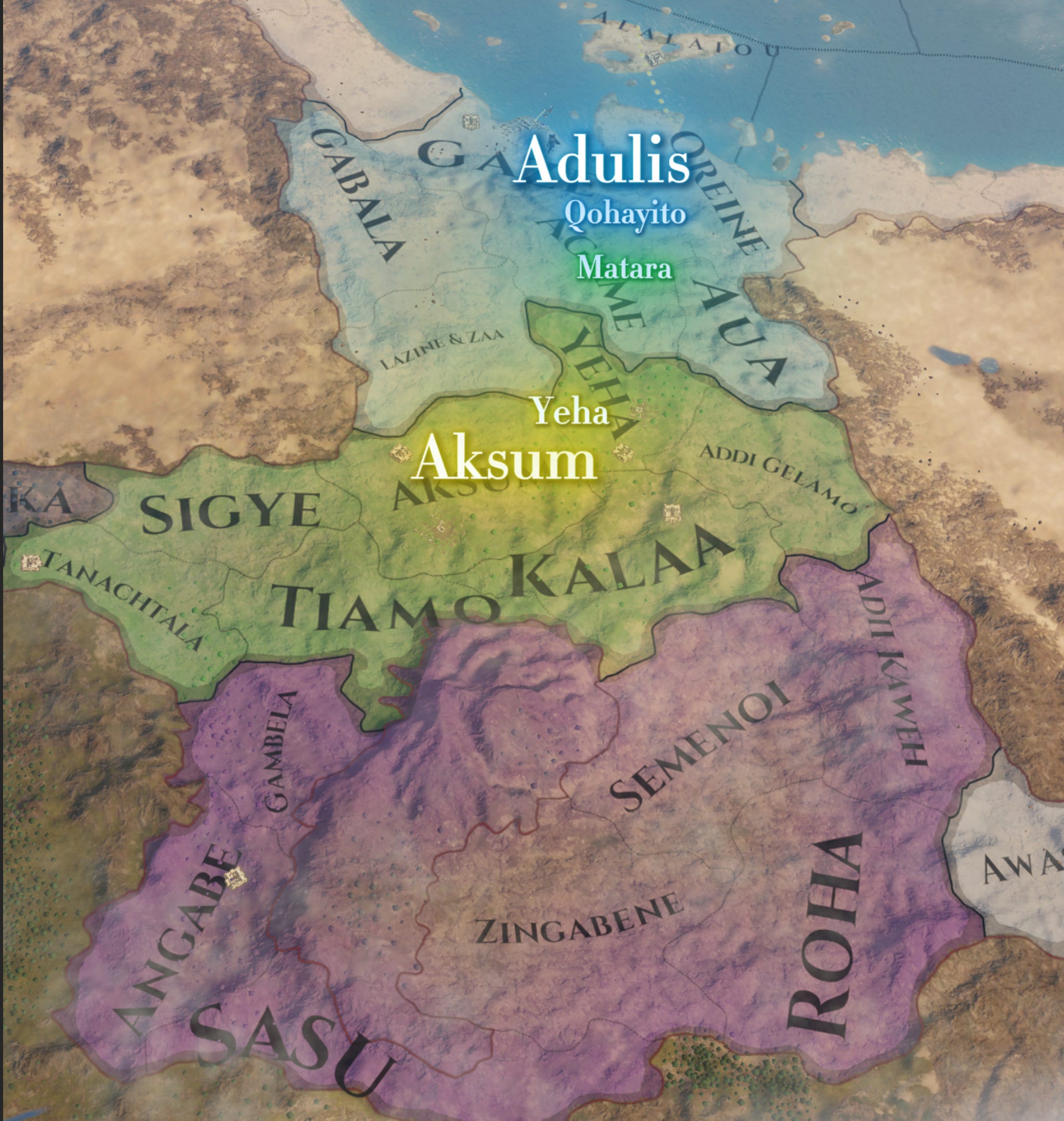
Rough map depicting the northern highlands and lowlands of Eritrea and Ethiopia in the early 2nd century AD. Own work.
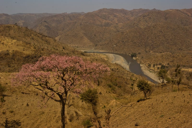
Around the turn of the 2nd century AD, the highlands of what are now Eritrea and Ethiopia were likely fragmented, with various polities controlling different regions1. Long-established cities such as Yeha and Adulis had already exerted significant influence over the plateau for centuries. Meanwhile, newer cities like Qohaito, Matara & Aksum were beginning to rise in prominence. Aksum, in particular, experienced increased growth during the late 1st century AD. The earliest known reference to the city appears in the Periplus of the Erythraean Sea(40 to 70AD2), which mentions a city of the ‘Auxumites’, which was a settlement located five days inland from Coloe (likely modern-day Qohayto3).
“Opposite Mountain Island, on the mainland twenty stadia from shore, lies Adulis, a fair-sized village, from which there is a three-day journey to Coloe, an inland town and the first market for ivory. From that place to the city of the people called Auxumites there is a five days' journey more; to that place all the ivory is brought from the country beyond the Nile through the district called Cyeneum, and thence to Adulis.” - Periplus of the Erythraean Sea, translated by Wilfred Harvey Schoff (1874-1932) - section 4.
Aksum’s growth during this period was likely driven by several factors, one of which was its advantageous access to trade routes extending deep into the southern and eastern hinterlands of Ethiopia & Sudan. This contrasted with sites like Adulis, which were more distant from these regions. However, there is no conclusive evidence of an established Aksumite kingdom/empire during the 1st century AD. Rather, Aksum was likely a powerful “city-state”, which steadily expanded its wealth and influence throughout the 1st and early 2nd centuries AD. This expansion possibly culminated in conflicts with other pre-existing polities, from which Aksum emerged victorious, becoming the dominant power in the highlands of Eritrea and northern Ethiopia.
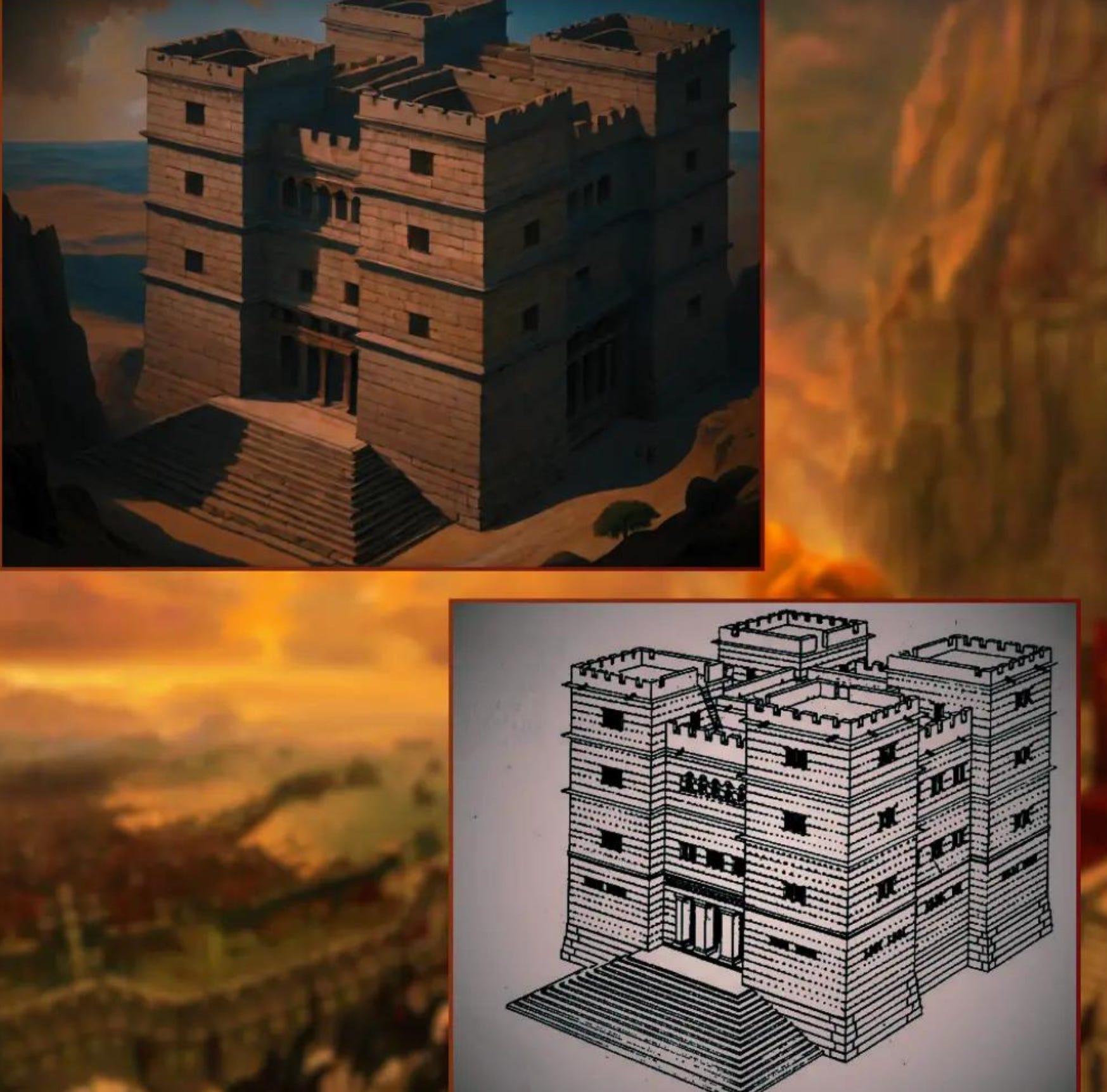
In terms of archaeological evidence, there is a notable absence of findings directly within Aksum that can be securely dated to the 1st century AD. Even in the surrounding areas, evidence from this period remains limited. However, one significant site just north of Aksum, Beta Giyorgis (roughly translates to House of Saint George), does show signs of occupation during the 1st century AD.
Some scholars have identified Bete Giyorgis as a “proto-Aksumite” site. Specifically at the archeological sites known as Ona Enda Aboi Zewgè (roughly translates to Ruins Of Father Zewgè), several graves containing pottery and stelae have been discovered4. A large building reminiscent of a palace was also unearthed at the nearby site of Ona Nagast (roughly translates to “Ruins Of Kings”), alongside numerous pre-Aksumite and proto-Aksumite elements, including multiple glass fragments dated to around the 3rd century AD5.
A large “proto-aksumite” building found at Beta Giyorgis. Source: The Proto-Aksumite Period: An Overview, pg 13.
Could the palace at Beta Giyorgis have been built for the conqueror recorded in the Monumentum Adulitanum II, or perhaps for his descendants in the third century AD?
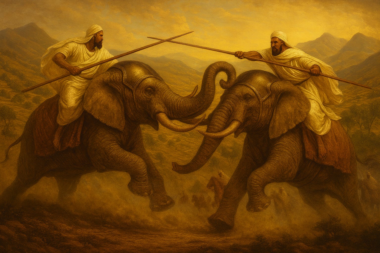
Civil War In The Highlands?
Two Mahout warriors engage in combat during the proposed “Civil War” in the highlands. Own Work
Around 143–155 AD (likely 144 AD6, the exact date of The Roman Oration remains debated among scholars7), a possible glimpse into events unfolding in the highlands of northern Eritrea and Ethiopia emerges through the following passage from The Roman Oration by Aelius Aristides.
“Even if somewhere on the borders clashes should occur… through the madness of the Dacians, or the ill fortune of the Moors, or the wretchedness of the people of the Red Sea … these wars and the discussions about them have quickly passed away like myths.” - Aelius Aristides To Rome/The Roman Oration (ON THE CONCEPT OFBARBARIAN INAELIUSARISTIDES, PG 12)
Some scholars hypothesise that the “wretchedness” described along the Red Sea may refer to civil strife in the region during this period8. Adding to this hypothesis, scholar & historian G. W. Bowersock also notes that a Roman military detachment was sent to the Farasan Islands (off the Arabian coast, directly opposite Eritrea) in response to a “crisis”9, which could be linked to unrest or a civil war in northern Ethiopia and Eritrea affecting the safety of trade in the Erythraean Sea.
Reconstruction Of Castle Of Enda Mikael (House Of Michael). Source: Ältere denkmäler Nordabessiniens, pg 107 & Colored Reconstruction is by Tigrayan.griot
In my view, one or more wars likely took place during this period between the various highland polities, particularly between Aksum and Adulis, from around 150 AD.10 There are several reasons to support this view. Firstly, Roman sources mention disruptions in the Red Sea and a subsequent Roman intervention. Secondly, the period was followed closely by the rise of Aksum, which undoubtedly led to conflicts with adjacent territories. Lastly, the first section of the Adulis Throne inscription (which we will soon analyse) refers to the conquest and subjugation of several nations in and around the highlands.
Ptolemy’s Geography (written around ~150AD11) mentions both Aksum and Adulis; however, he uniquely notes that Aksum was the site of a “royal palace”. This detail lends weight to the view that Aksum had risen in power by this period, sufficiently so for Ptolemy to single it out as the seat of a king or emperor. In contrast, no such reference to a “royal palace” is made for either Koloe (Qohayto) or Adulis.
This does not imply that royal palaces did not exist in Qohayto or Adulis. As discussed in my other articles, archaeologists have uncovered palace-like structures in both locations. Rather, Ptolemy’s specific mention of Aksum’s royal palace may reflect its greater grandeur, surpassing that of the others, and thus signifying its primacy over the other cities.
“The cities away from the river in the interior are:
However, even if the Aksumites rose to prominence during this period, it does not imply that other identities (such as the Adulites) were entirely erased. This is evident in Ptolemy’s Geography, which refers to both the Adulitae and the Axoumitai as distinct groups. At the very least, this suggests that separate identities between these two populations were still recognised at the time.
“The coast all along the Arabian gulf and the Avalites gulf is called Troglodytike as far as the Elephas mountain, in which region are the Adulitae, and the Avalitae near the gulfs with the same name, and the Mosyli above the promontory with a market place of this name. The entire seacoast to the Rhapton promontory is called Azania; the interior region is called Barbaria, in which there are many elephants.
The Kolobi occupy that part of the region toward the east from the river which is near the Bazium promontory; next to these toward the south are the Tabieni; then the Sirtibes; next to these are the Attiri; then the Babylleni and the Rhizophagi; then the Axoumitai " - Book 4, Chapter 7, Section 27 of Ptolemy's "Geography
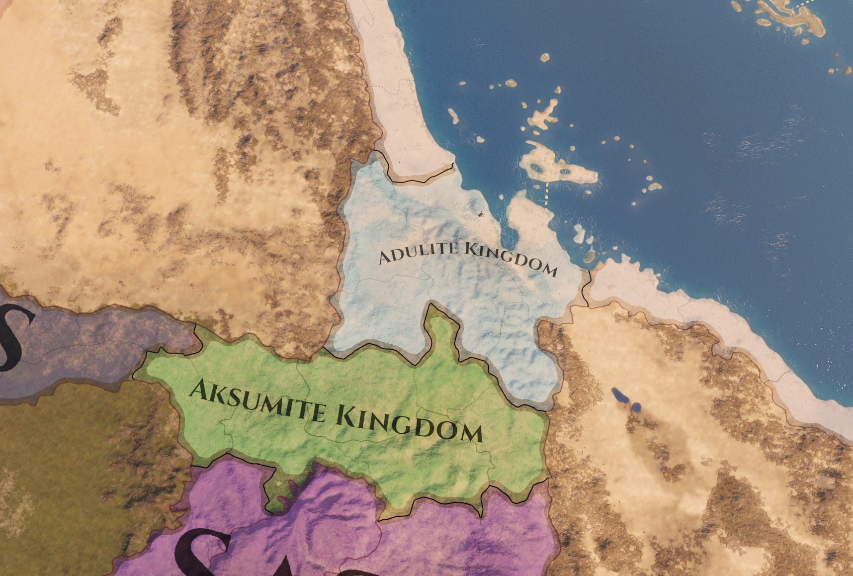
Theoretical map showing the political landscape of the Eritrean and Ethiopian highlands, along with spheres of influence during the early 2nd century AD - Aksumite and Adulite Kingdoms. Own work
In my opinion around 150 AD, the initial conquests described in the Monumentum Adulitanum II were likely underway, marking the unification of the highlands and the probable consolidation of both the Aksumite and Adulite kingdoms, into a single entity: The Aksumite Empire.
War Against Meroe?
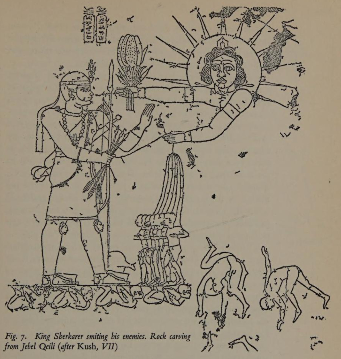
Some scholars hypothesise that during the reign of King Sherkarrer (or Shorkaror) of Meroë in the early 2nd century AD, the Aksumites launched an unsuccessful expedition against Meroë12. Supporting evidence comes from a rock carving at Jebel Qeili near modern-day Kassala (Central, Eastern Sudan, close to the border of Eritrea). The carving depicts King Sherkarrer alongside a god-like figure (possibly Apollo, the sun god), with slain enemies beneath them, which some scholars believe might represent Aksumite warriors13.
Rock carving at Jebel Qeili, depicting King Sherkarer defeating his enemies. Source: Meroe : a civilization of the Sudan, pg 51.
As we will explore in the next section, the unnamed conqueror referenced in the Monumentum Adulitanum II inscription notably omits any claim of conquering Meroe. This omission was almost certainly not due to ignorance, since several other neighbouring polities are explicitly mentioned, but rather reflects a likely inability to subdue Meroe at the time.
It was not until the late 3rd century AD, during the reign of Emperor Ousanas, that the Aksumite Empire finally succeeded in defeating Meroe.
The Unnamed Conqueror (160–200 AD)
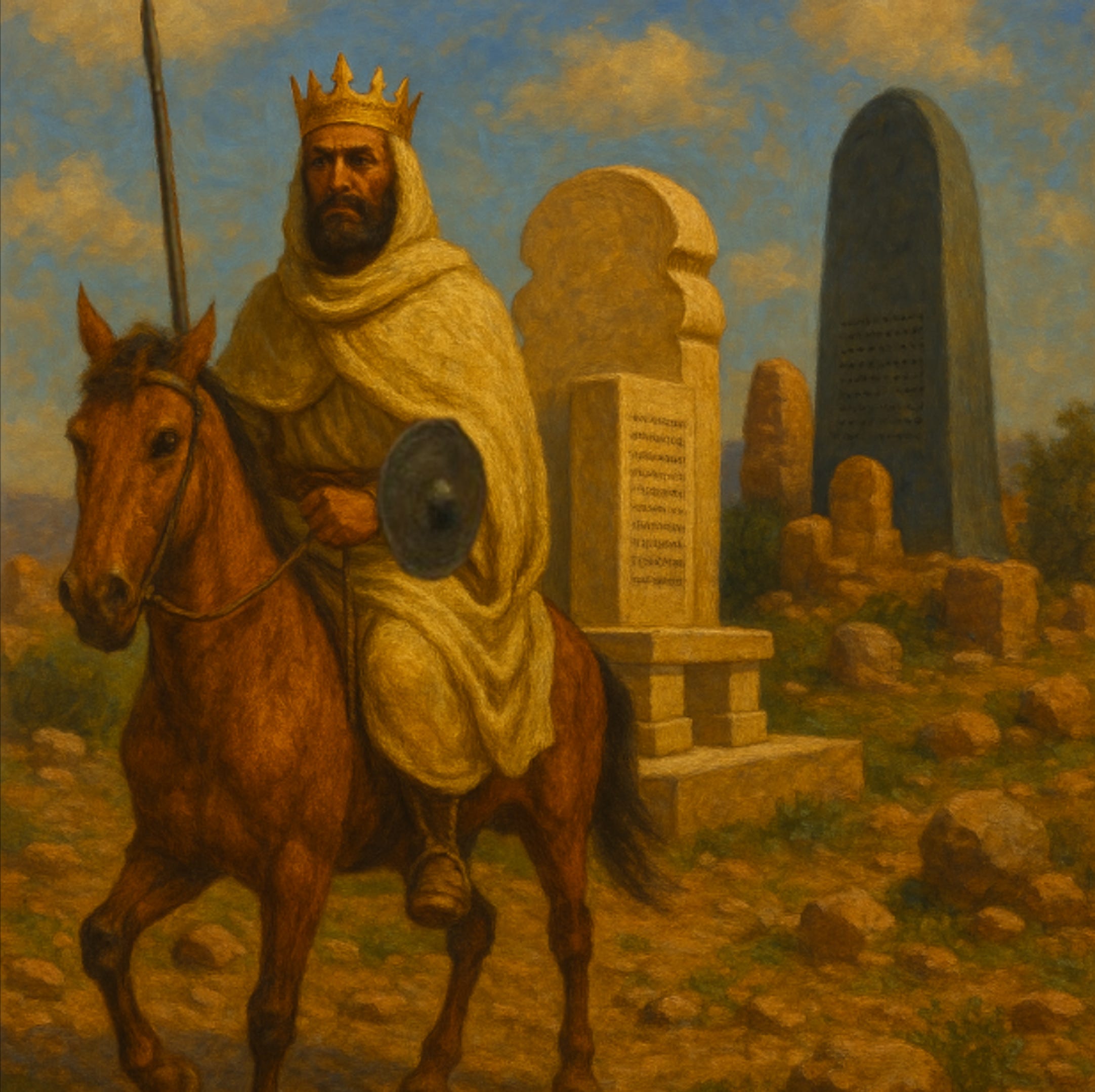
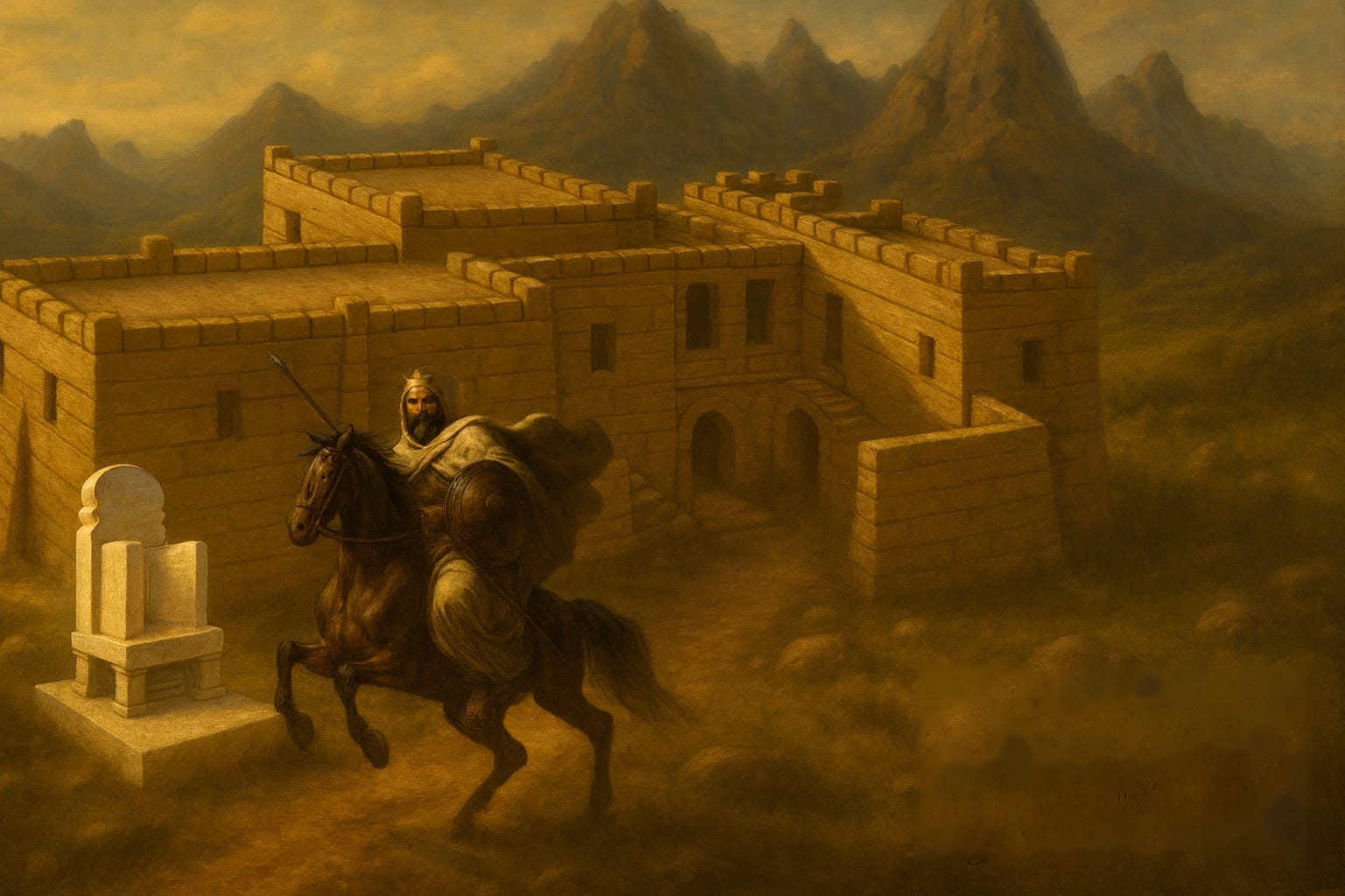
The conqueror of Monumentum Adulitanum II, in front of the Adulis Throne & Stelae. (Own-Work)
The Throne at Adulis
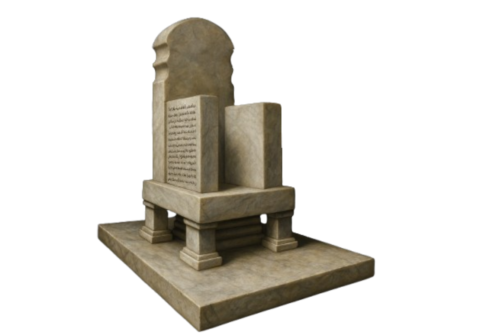
The Adulis Throne (Monumentum Adulitanum II) as described by the 6th-century traveller Cosmas Indicopleustes. Own Work
The reign of the unnamed conqueror is recorded in an indigenous inscription on a marble Throne at Adulis. This throne bears a Greek inscription on both its sides, detailing a ruler who would conquer an Empire spanning a vast region along the coast of the Erythraean Sea. In the 6th century AD, Cosmas Indicopleustes, a Byzantine traveller, mistakenly believed the inscription to be a continuation of a nearby stele associated with Ptolemy III. However, modern scholarship has since disproven this, as discussed in greater detail in my article on Adulis.
The inscription written on the Throne at Adulis is called: Monumentum Adulitanum II (RIÉ 277)
To interpret these campaigns accurately, the first step is to determine the most probable date of the Adulis Throne, thereby establishing when these conquests took place.
Dating the Adulis Throne
The exact date of the Greek inscription on the Adulis Throne remains a subject of scholarly debate. Historian Glen Bowersock proposes that the events described in the inscription occurred in the late 2nd century AD or early 3rd century AD14. I have also concluded that this is the most likely date when the events on the throne occurred. My reasoning is as follows.
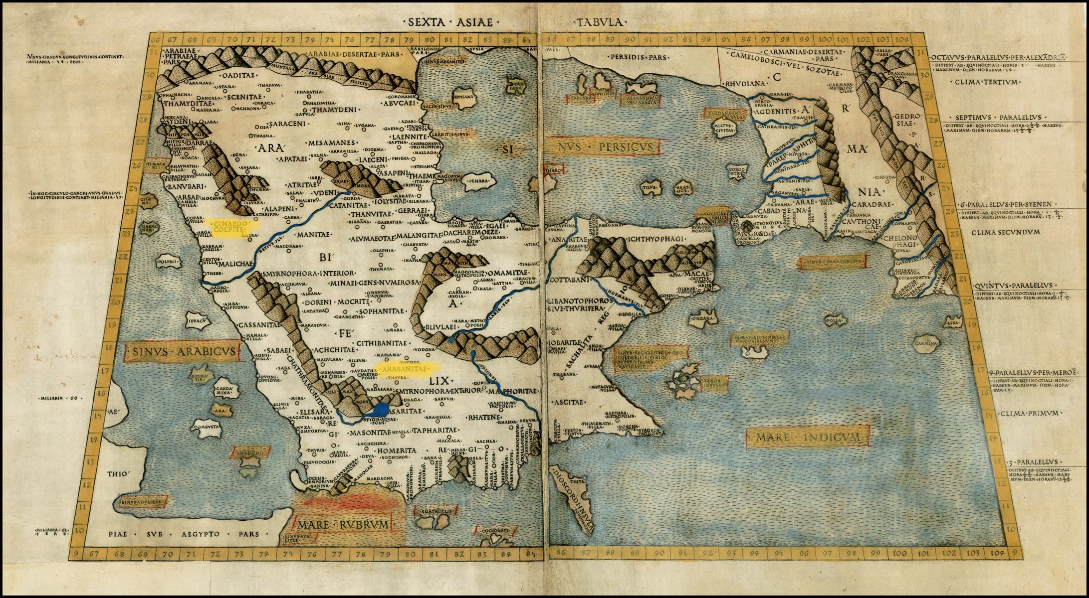
The Kinaidocolpitai
Map of Arabia based on Jacopo d'Angelo's translation of Ptolemy (1478). The Cinaedocolpitae/Kinaidocolpitai are located in the northwest. (Source)
The Kinaidocolpitai are a notable group mentioned exclusively between 150 AD and 300 AD15. The Kinaidocolpitai are mentioned in the Adulis Throne & various historical documents, including Ptolemy's "Geography", but they seem to disappear from records by the mid-third century16. This disappearance supports the hypothesis that any inscription mentioning them must have been created during their known period of existence. Thus, an outer and inner boundary in our time frame for the Monumentum Adulitanum II is set: 150AD-300AD.
In the country of the Kinaidokolpitans: Kopar kome . 68°30' . 23°15' Arga kome . 69°00' . 22°40' Zabram palace . 69°20' . 22°00' Kentos kome . 69°20' . 21°30' Thebai city . 69°40' . 21°00' mouth of Baitios river . 69°30' . 20°40' river sources . 76°00' . 24°30'
This Sabaic inscription, known as Robin-Umm Layla 1, is dated to 160 AD. The inscription indicates that the Aksumites had already penetrated the Yemeni highlands, prompting local tribes to form an alliance in response to the perceived threat. Source
Secondly, the earliest known South Arabian inscription mentioning the “Habeshas” was discovered at the ʾUmm Laylā fortress in the Yasnam area of Qatābir District, the northernmost governorate of Yemen. It records an invasion by the Habeshas (b-nḥbšn) into Sabaʾ, specifically near Umm Laylā. Scholar Christian Julien Robin dates the inscription to between 160 and 190 AD17, based on references to the Banū Sukhaym tribe, which was ruling Sabaʾ at that time.
South Arabian inscriptions from this period commonly use the term “Habeshas” to refer to foreigners from the highlands of Eritrea and Ethiopia. However, the specific polities that are encompassed by this term remain uncertain, at least until the rise of the Aksumite Empire in the 3rd century AD, when clearer correlations can be drawn.
“A decision and agreement was made after the gathering of the people of Khawlān al-Judad, including the Aḥnub, Aʿbūs, and Yashbam tribes, as well as all their allied groups. Also participating were the tribes of Abqūr and Shabraqah, who accepted and welcomed the alliance with them.
They all agreed to build defensive fortifications against the Ḥabashites (Abyssinians) who had invaded their land. This was done with the strength and sanctity of their god ʿAthtar—specifically ʿAthtar Dhū-Riḥab, ʿAthtar Dhū-Ḥaḍrān, and ʿAthtar of Kabdān, along with Laḥay ʿAthtat, the god of eclipses. This act was also carried out with the authority and command of their lords, the kings of Sabaʾ and the Banū Sukhaym, and under their guidance, they constructed the fortifications in Karīfayn, Yaghl, and Harn.” - Robin-Umm Layla 1
As we shall see later, the conqueror mentioned in the Monumentum Adulitanum II records Saba as the northernmost limit of his campaigns. Could this suggest he was defeated there, hence the Sabaic inscription known as Robin-Umm Layla 1 referring to the Adulis Throne’s conqueror attacking Saba during the period 160–190 AD?
Inscription Date: 160-200AD
Therefore, based on the analysis of the Sabaic inscription dated to 160–190 AD, the reference to the Kinaidokolpitai, who are attested between 150 and 300 AD and as previously discussed, the Roman sources reporting major unrest and warfare around 150 AD, including the deployment of a Roman detachment to the Farasan Islands in the Red Sea, we arrive at the same conclusion held by most scholars: the inscription likely dates to the late 2nd century AD, specifically from 160-200AD. This view is supported by both scholars, David W. Phillipson18 and Glen Bowersock19.
Who was the Emperor?
The second key question regarding the Monumentum Adulitanum II inscription is the identity of the emperor whose conquests it records. As the inscription does not mention a name, we must rely on educated speculation. Scholars remain divided over who this emperor was and which kingdom he ruled. Based on the previously estimated date of 160–200 AD, no known emperor can be definitively linked to this period. The closest candidate is Emperor GDR (often vocalised as Gadara), who appears in Sabaic inscriptions dating to 200–220 AD.
However, identifying the emperor as Gadara can be problematic, as his earliest known references appear as much as 40 years after the earliest possible date of the first Sabaic inscription mentions Habeshas. It is therefore plausible that Gadara was the successor of the conqueror described in the Monumentum Adulitanum II.
Nevertheless, Scholars such as Glen Bowersock have also suggested that the ruler could have been Gadara20. I’m also of the opinion that it was either Gadara or a direct predecessor.
Loading...
Aksum or Adulis?
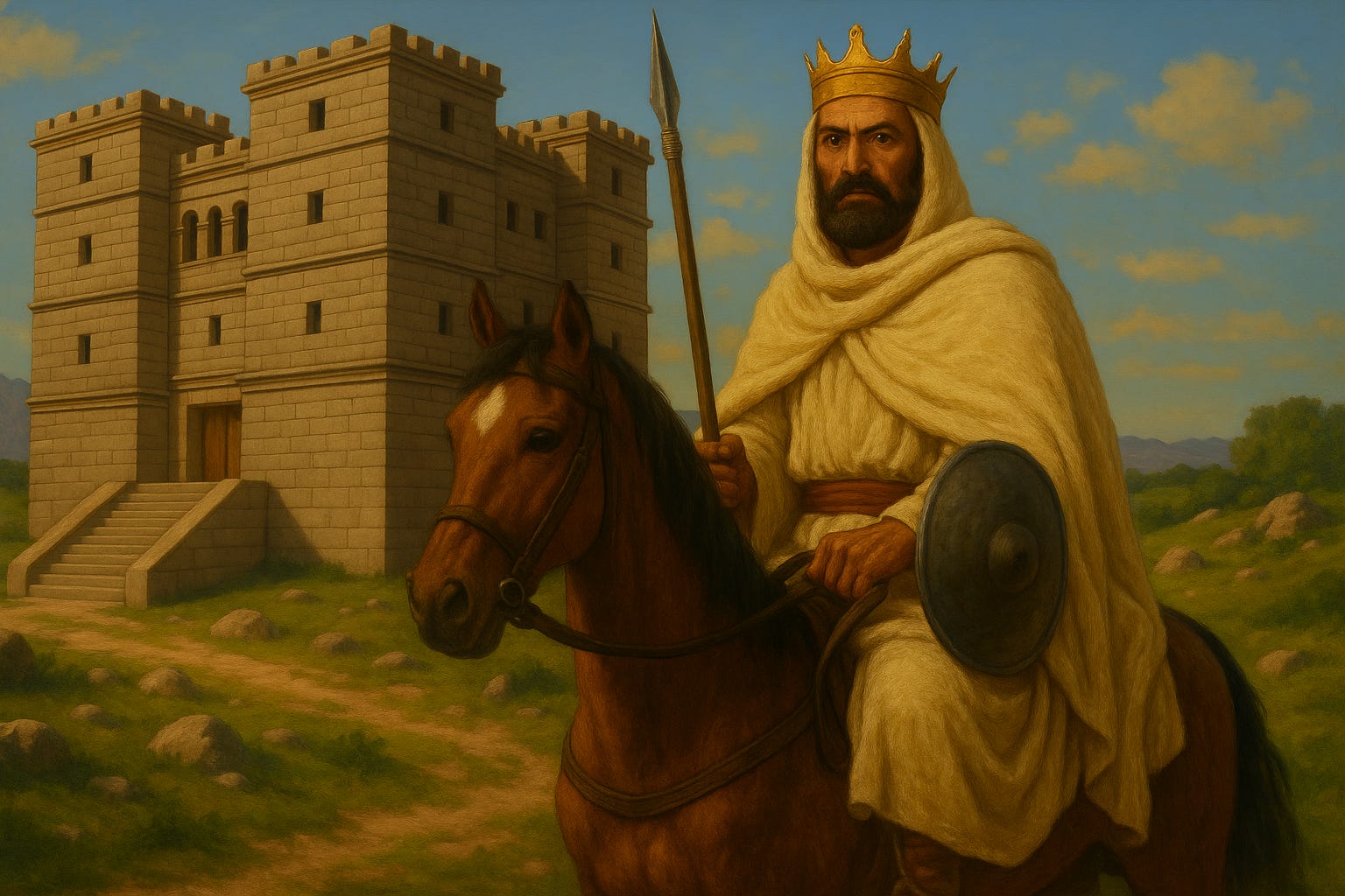
The Conqueror of Monumentum Adulitanum II in front of his royal palace near Aksum. Own Work.
As for the empire to which the emperor belonged, most scholars have traditionally attributed the inscription to the Aksumite Empire (see Munro Hay21, Glen Bowersock22). However, more recent scholarship has proposed that it refers instead to Adulis itself (see David W Phillipson23). These scholars highlight that the inscription was physically located in Adulis and that the emperor explicitly states he "gathered" his troops there, implying that Adulis functioned as the imperial centre.
“Gaze means the Aksumites. Until now they are called Agaze” - Source: Encyclopaedia Aethiopica A-C, pg 144.
In contrast, proponents of the Aksumite interpretation26 highlight that Aksum was already emerging as a dominant power by the late 2nd century AD and had likely surpassed Adulis in political and military significance. They argue that the conquests described in this were the first step and directly related to the rise of the Aksumite Empire in the 3rd century AD.
The 11th-century copies of Cosmas Indicopleustes’ Christian Topography include a footnote stating that the tribes near Adulis belong to the tribe τιγρητῶν27(tigrētôn), the plural of Tigrētēs. Although this note was written some five centuries after Cosmas, it broadly corresponds to the location of some Tigrē people today, such as the Mäsǝḥalit sub-clan of Tigrē who still live around Zula to this day28.
In addition, certain Saho groups, such as the Iddefer & Asaorta tribes also live around Zula2930.
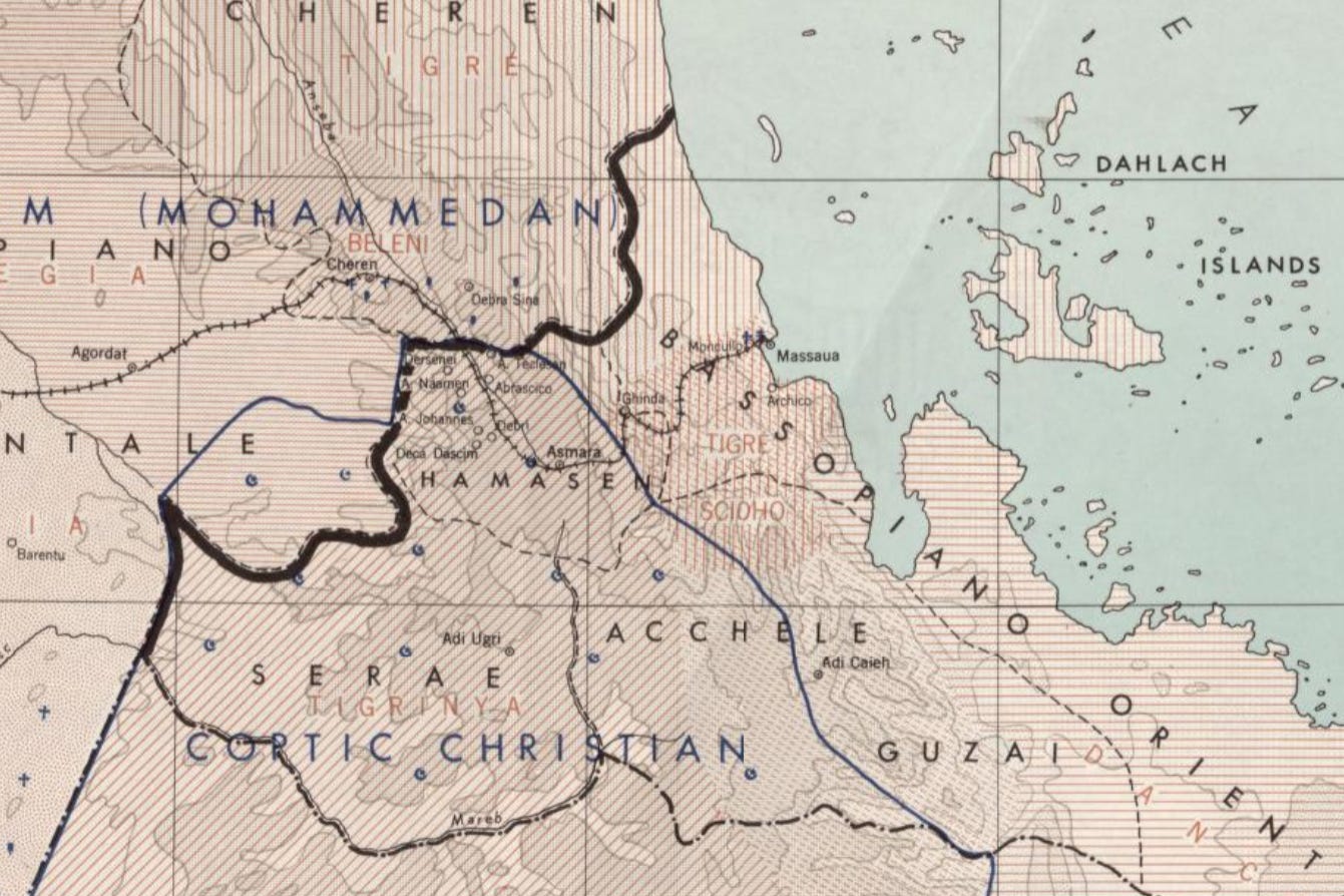
Tribal Map of Eritrea, 1949 by the United States Central Intelligence Agency. Source
My theory
In my view, the ruler in question was part of the Aksumite Empire, though he likely governed from both Aksum and Adulis. I came to this conclusion because of several factors, for example, an inscription dated to 200–220 AD (Ja 631), which identifies Emperor Gadara as an Aksumite. Thus, if the emperor who commissioned the Adulis Throne was Gadara or even his direct predecessor, it leaves little room for a significant shift in political identity in such a short period (<20-40 years), in addition to this the reference of the Aksumite Royal palace by Ptolemy but not any others also leads to thinking Aksum was the strongest power at this time.
However, the reference to gathering at Adulis in the throne inscription, along with its physical placement there & the Hellenistic influence, suggests that Adulis may have served as the emperor’s primary seat of power or at least held a status equal to that of Aksum during the time of the inscription.
This is similar to how Babylon became the long-term capital and residence of Alexander the Great after his eastern conquests and where he eventually died31. A ruler may originate from a foreign land (such as Aksum) yet place particular emphasis on a neighbouring city (like Adulis) because of its historical & strategic significance.
The absence of definitive evidence confirming whether the emperor referenced in Monumentum Adulitanum II hailed from Adulis or Aksum has led scholars to propose varying hypotheses. As such, there is no single “correct” answer. Beyond modern-day displays of point-scoring (which ultimately hold little significance), the fact remains that this leader emerged from the highland region of present-day Eritrea and Ethiopia. He placed considerable importance on the city of Adulis and played an important role in shaping the history of the Aksumite Empire and, by extension, that of both Eritrea & Ethiopia.
Nevertheless, a few key facts about the Monumentum Adulitanum II are clear. The emperor mentioned in the inscription hailed from modern-day northern Ethiopia & southern Eritrea, ruling in the late 2nd to early 3rd century AD and went on to establish the largest empire in the history of the region, extending across both shores of the Erythraean Sea.
Loading...
The Conquests
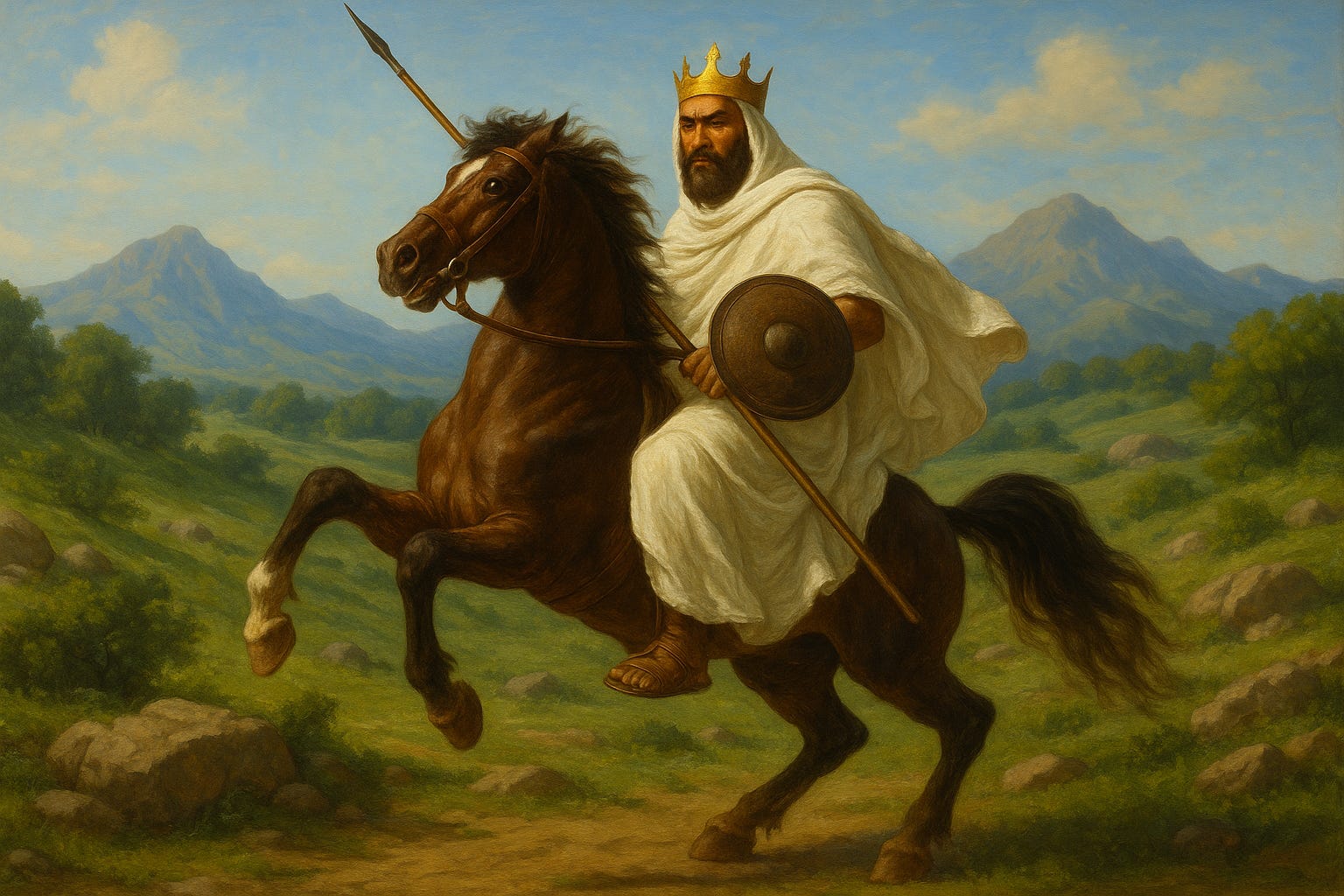
The Conqueror of Monumentum Adulitanum II on horseback. Own Work.
Finally, we arrive at the analysis of the conquests detailed in the Monumentum Adulitanum II inscription. Given the length of the text, I will break it down and examine each section individually, including relevant quotes throughout. It is important to note that not all the locations or nations/peoples mentioned in the inscription are identified with certainty. While some, such as Agame, are well known and still exist today, others, like Zaa and Gabala, remain obscure. Where possible, we will rely on historical and contextual evidence to make informed interpretations.
Unification of highland City-States
The first phase of conquests recorded in the Monumentum Adulitanum II. Own work. Right: Proposed theory 2 - Conquests started from Adulis
As discussed in the introductory section of this article, the highlands of Eritrea and Ethiopia during the 1st and 2nd centuries AD were politically fragmented. Since the fall of DʿMT around the 4th century BC, no unified kingdom/empire is known to have existed, besides the Empire of Zoskales (which was largely a coastal empire). Instead, regional polities such as Adulis, Matara, Yeha, and Aksum functioned as independent centres of power.
All of this, however, was about to change, as we will see in the following excerpt from the inscription on the Adulis Throne:
“Having after this with a strong hand compelled the nations bordering on my kingdom to live in peace, I made war upon the following nations, and by force of arms reduced them to subjection. I warred first with the nation of Gaze, then with Agame and Sigye, and having conquered them I exacted the half of all that they possessed.” - Cosmas Indicopleustes, Christian Topography (1897) pp. 23-90. Book 2, section 142
Firstly, it is possible that Cosmas did not copy the introductory section preceding the inscription, which may have included the name of the emperor and his empire. Scholars such as Glen Bowersock support this view32. Regardless, the first surviving line states that the emperor "compelled the nations bordering on my kingdom to live in peace", likely referring to large villages or towns near his nucleus of power (Adulis/Aksum) being subjugated. In either case, securing the periphery would have been essential before conquering territories further away.
Glen Bowersock notes that ἀνδρειώσας (andreiósas) can imply either "manhood" or "manly strength”33. If the former is intended, it may suggest that the conqueror was still quite young at the time of his campaigns.
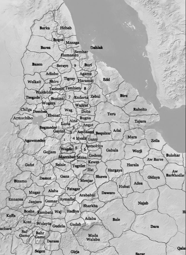
Map depicting the medieval provinces of Abyssinia and its peripheral territories. Source (Note: Number 9 is Akele Guzai; however, Buri/Bur sometimes encompassed Akele Guzai)
The first group mentioned are the Gaze (Γάζη), first attested during the DʿMT period around the 6th century BC. As previously noted, this term may refer to the Aksumites themselves (according to an 11th-century marginal note found in a manuscript of Cosmas Indicopleustes34). However, since this note does not appear in earlier 9th-century copies, therefore its reliability is questionable. Even if accurate, it is possible that by Cosmas’s time in the 6th century AD, the Agaze had already been assimilated into the broader Aksumite identity. Another theory proposed by scholars suggests that the Gaze were a people who once inhabited the Akele Guzay region35 & correlate them with the Agwezat, who are later mentioned in an Aksumite inscription as rebelling several times36.
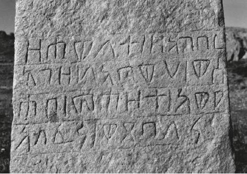
Proto Ge’ez Inscription At The Center Of The Hawulti Monument (This inscription mentions King A’ GZ). Source: Matara: the Archaeological Investigation of a City of Ancient Eritrea, Figure 4b
In my view, the Agaze were likely a group originating from the Akele Guzay region of Eritrea and northern Agame area of Tigray, who were later assimilated into the Aksumite identity, possibly through intermarriage with royal lineages in Aksum, thus the late reference in the 11th century copy of Cosmas’s manuscript37.
Interestingly, the late 18th-century explorer Henry Salt noted that the Gaze were located specifically near Adulis, in a region through which significant trade passed into the city.38 This suggests that conquering the Gaze territory was crucial for controlling the flow of goods in and out of Adulis.
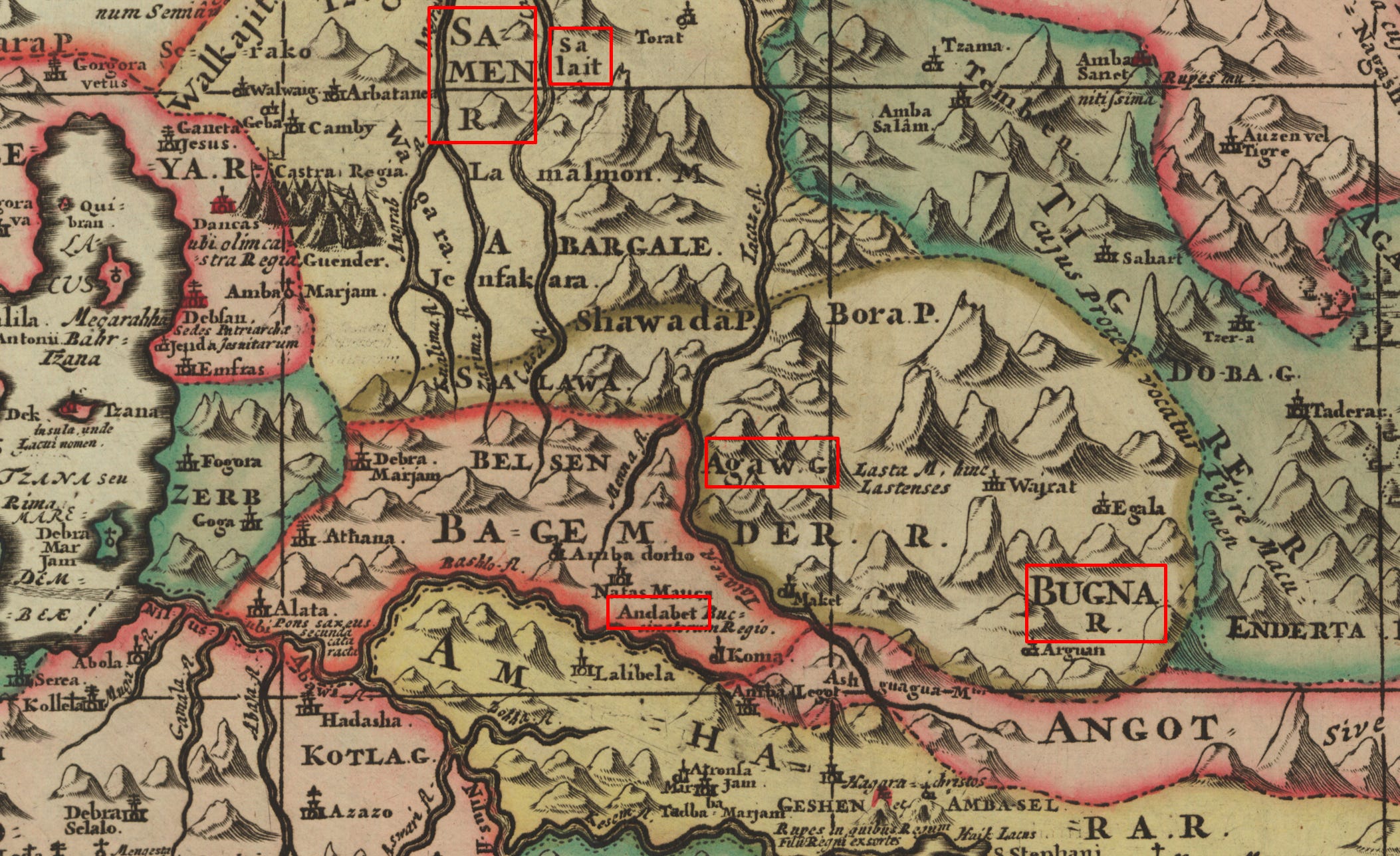
Next, the inscription mentions the Agame, a far more straightforward identification. This undoubtedly refers to the Agame region in north-eastern Tigray, which still exists today. As Bowersock notes, it was likely situated near the present-day city of Adigrat in Tigray.39
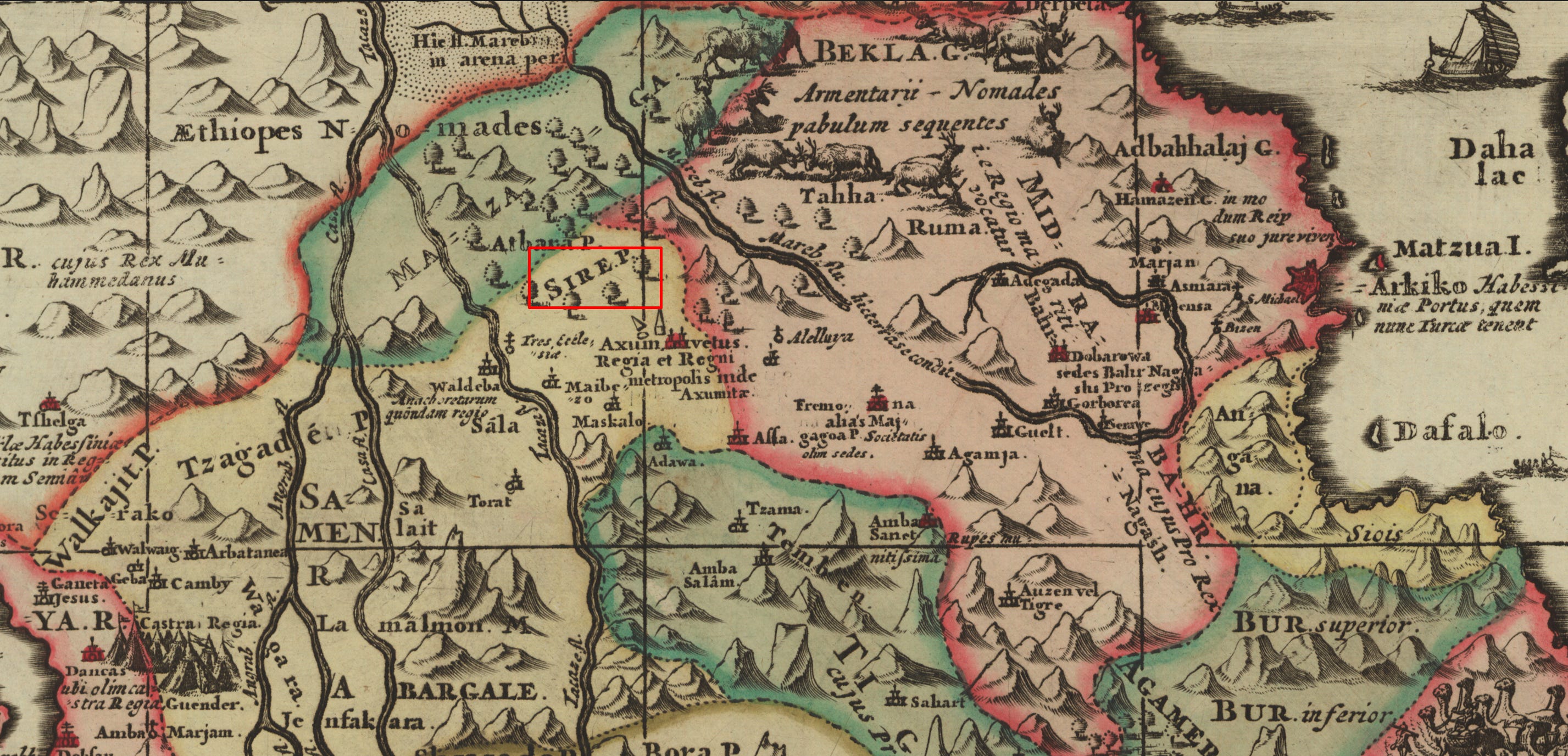
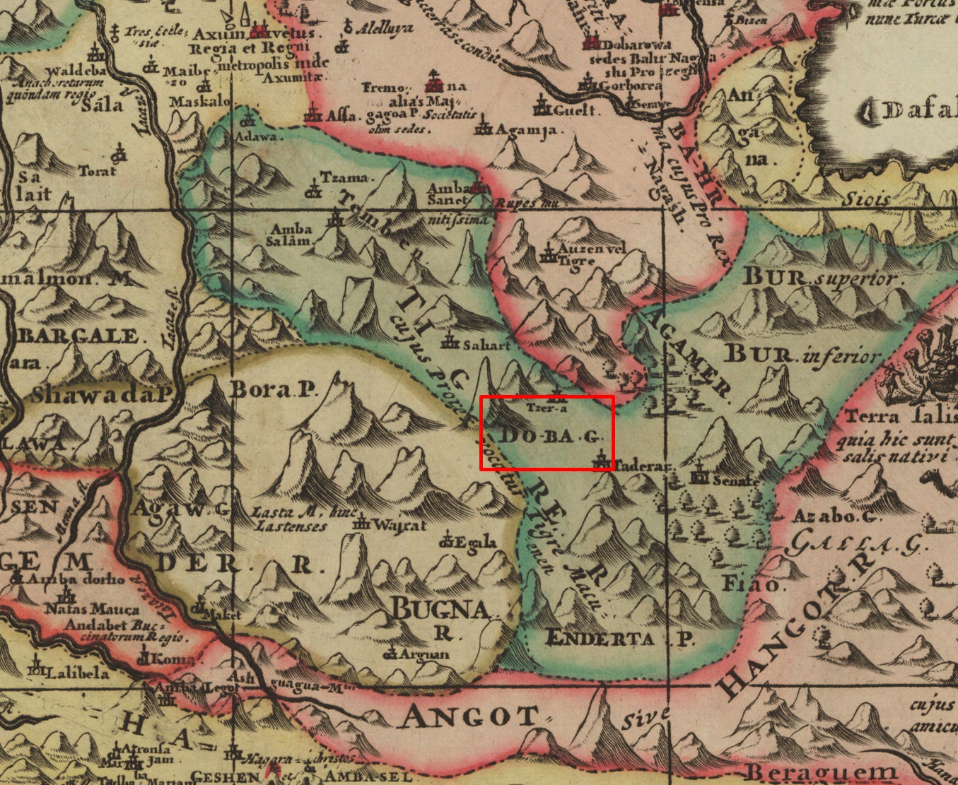
The region of Sire is highlighted in this snippet of a map of Abyssinia by Ludolf & Gorgoryos, 1683. Source
The final territory mentioned in this initial section is Sigye (Σιγύην, i.e. the people of Sigýē). An 11th-century copy of Cosmas Indicopleustes’ Christian Topography includes a footnote identifying the Sigye as the Suskinitai40, though this offers little clarity regarding their precise identity. However, some possibilities exist. The late 18th-century traveller Henry Salt noted that “Sigue” means “Sire”41, likely referring to Shire in western Tigray. Additionally, the 1683 map of Abyssinia by Ludolf and Gorgoryos places a region called “Sire” near Aksum, likely a variant of the term Shire.
This identification of Sigye as an early form of shire seems plausible, as Shire lies just west of Aksum and would have been a strategically significant region to conquer early on, due to its proximity.
Lastly, the conqueror claims to have seized half of the property (likely referring to livestock, goods, and people), likely to replenish his manpower and resources, thereby enabling his further campaigns.
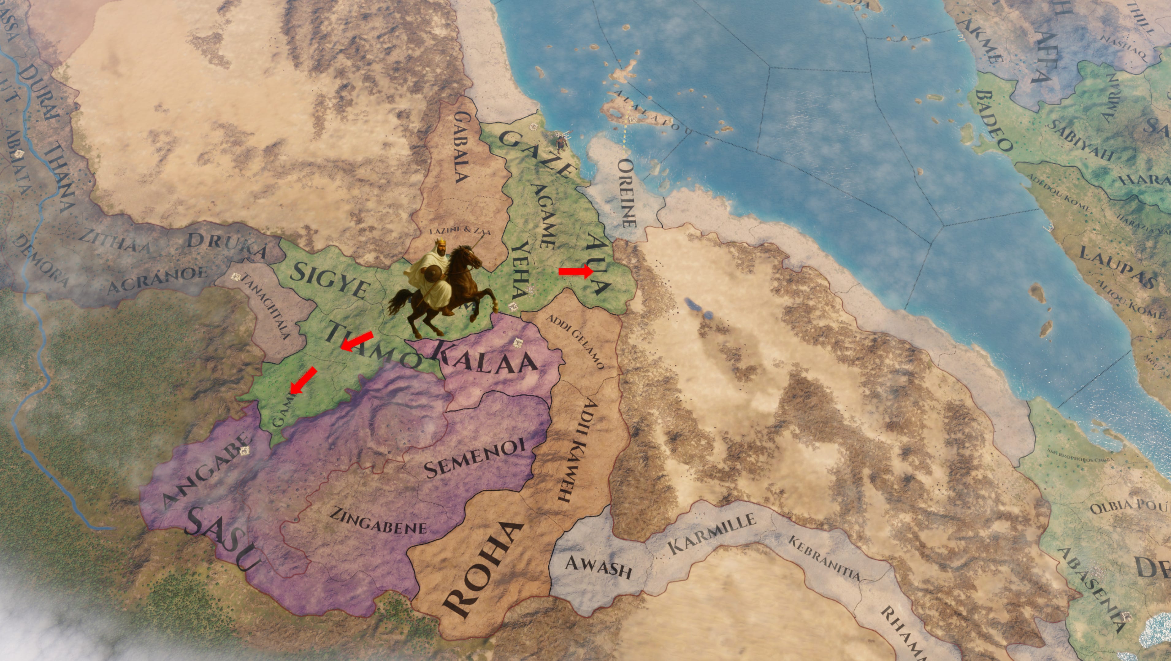
Further Conquests: Aua, Tiamo, and Gambela
The 2nd phase of conquests recorded in the Monumentum Adulitanum II. Own work.
We now move on to the 2nd section of his conquests. The first people or territory he mentions conquering is a place called Aua. This might refer to the city of Adwa and the people who inhabited that region at the time. According to Henry Salt42, the name Adwa might derive from Adi-Awa (meaning land of Awa). Adwa is a city located northeast of Aksum in present-day Ethiopia.
The difficulty with this identification lies in the fact that the city of Aua was also mentioned by a Roman ambassador in the 6th century during a visit to Emperor Kaleb: ‘He tells us that Adulis is fifteen days’ journey from Axumis. On his way there, he and his companions saw a remarkable sight in the neighbourhood of Aue (Ave), midway between Axumis and Adulis’43. If Aua was indeed midway between Adulis and Aksum, this rules out Adwa, which lies barely 50 km from Aksum. This would instead suggest that Aua was located near Matara. However, it is also possible that these references are to two different places named Aua.
Next is Tiamo (or Tziamo). The exact location of this region or people remains uncertain. However, as with Sigye, the 11th-century copies of Cosmas’s Christian Topography include a footnote stating44: “Τίαμα τοῦς λεγουμένος Τζιαμῶ καὶ τοὺς Γαμβελὰ καὶ τὰ ἐγγὺς αὐτῶν λέγει ἔθνη τὰ πέραν τοῦ Νείλου.” This translates as: "He says that Tiama refers to those called Tziamō and the Gambēla, and the tribes near them across the Nile."
The region of Tzama is highlighted in this snippet of a map of Abyssinia by Ludolf & Gorgoryos, 1683. Source
There are two ways to interpret the location of Tziamo. Firstly, the following section mentions the people known as the Semenoi, who are likely to have lived in the Sémen Mountains, situated further south of Tigray. This suggests that the regions previously listed, including Tziamo, likely lay in the general direction south of Aksum. Secondly, a 17th-century map by Ludolf and Abba Gorgoryos places Tzama directly to the south of Aksum, supporting this interpretation.
As for the Gambēla, they were possibly located in the same general area. The 18th-century traveller James Bruce mentions them as residing in the Enderta region of south-eastern Tigray45.
Conquests around the Sémen Mountains
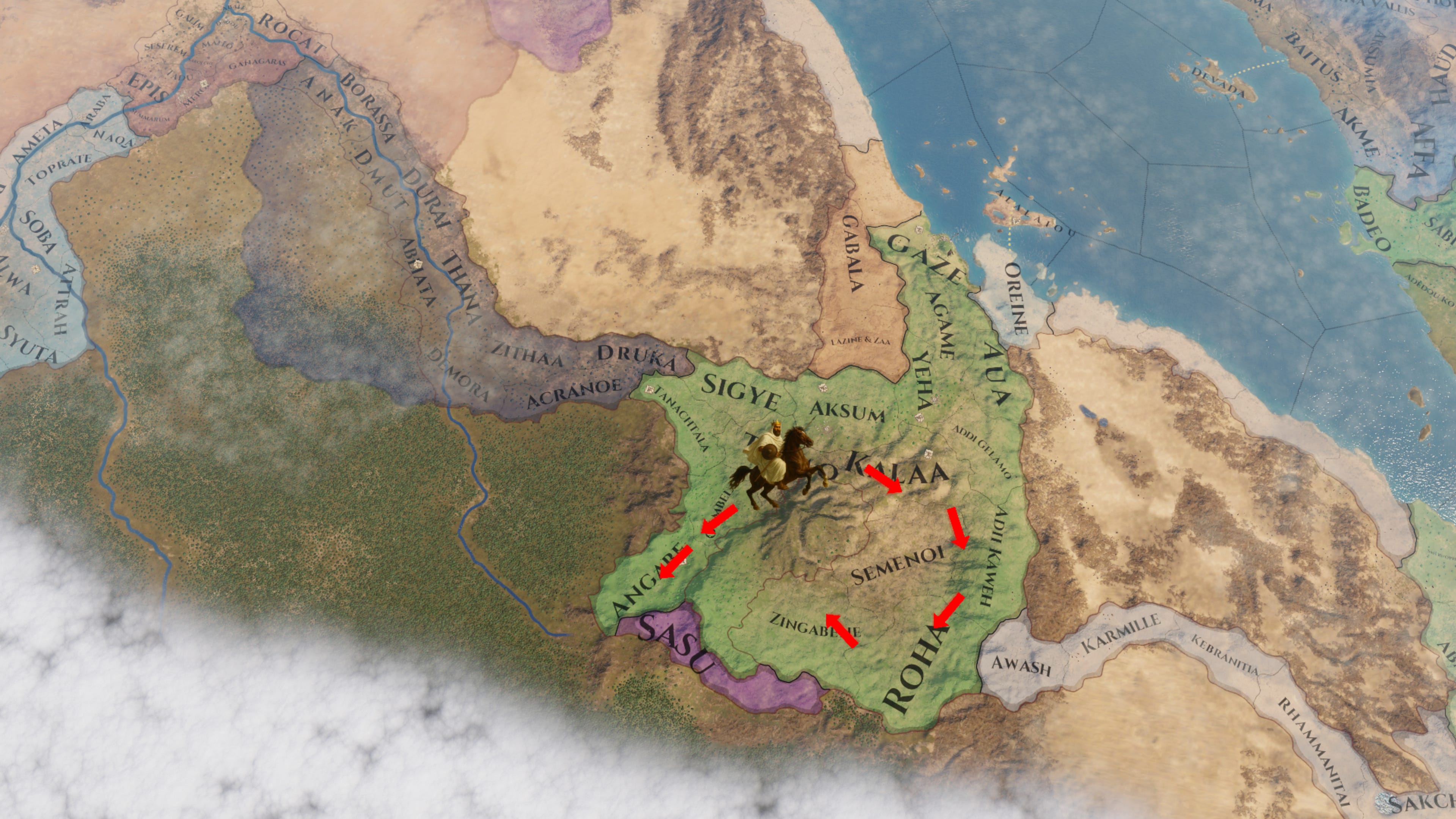
The 3rd phase of conquests recorded in the Monumentum Adulitanum II. Own work.
ὡς μέχρι γονάτων καταδύνειν ἄνδρα, τὸν ποταμὸν διαβὰςὑπέταξα.”
“and Zingabene and Angabe and Tiama and Athagaus and Kalaa, and the Semenoi — a people who lived beyond the Nile on mountains difficult of access and covered with snow, where the year is all winter with hailstorms, frosts and snows into which a man sinks knee-deep. I passed the river to attack these nations, and reduced them.” - Cosmas Indicopleustes, Christian Topography (1897) pp. 23-90. Book 2, section 142
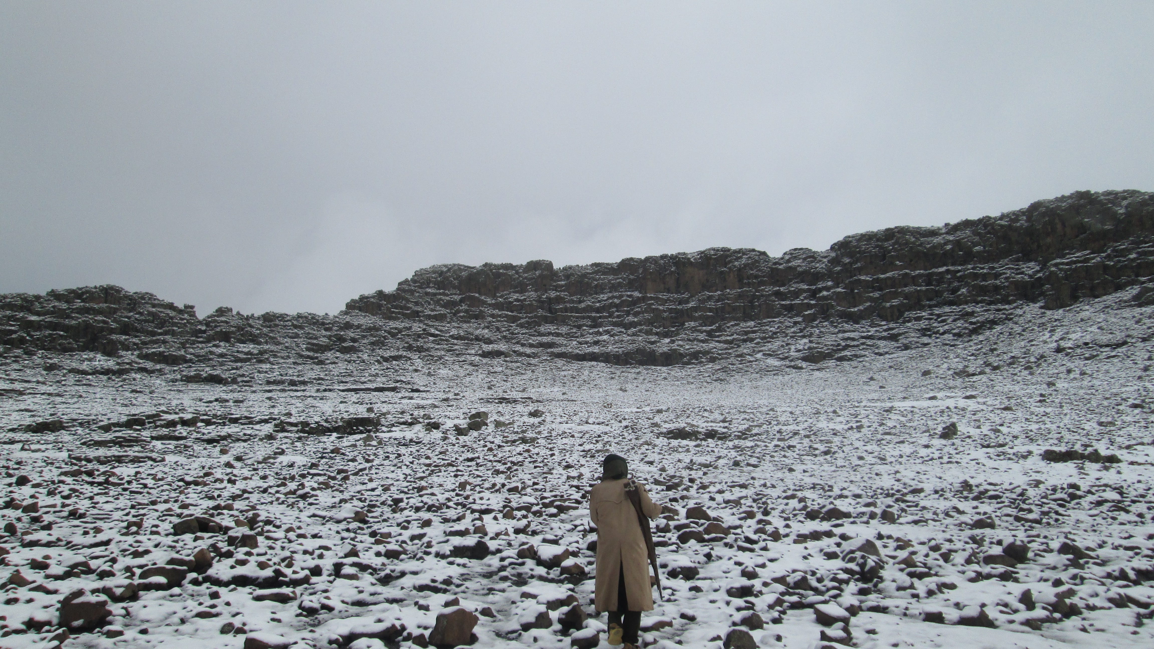
Sémen Mountains at the Summit of Ras Dashen. Credit
As for the Zingabene, their precise location remains unknown. Our only clue comes from Henry Salt46, who associated them with the Bugna region, historically part of north-western Wollo province. Interestingly, Bugna was also the seat of the Begwenā Dynasty, commonly known as the Zagwe Dynasty. The area lies near the Täkkäze River, a tributary of the Nile.
The mention of the Athagaws next, which is almost certainly the Agaws, who historically lived around the Bugna area, further adds credence to this theory.
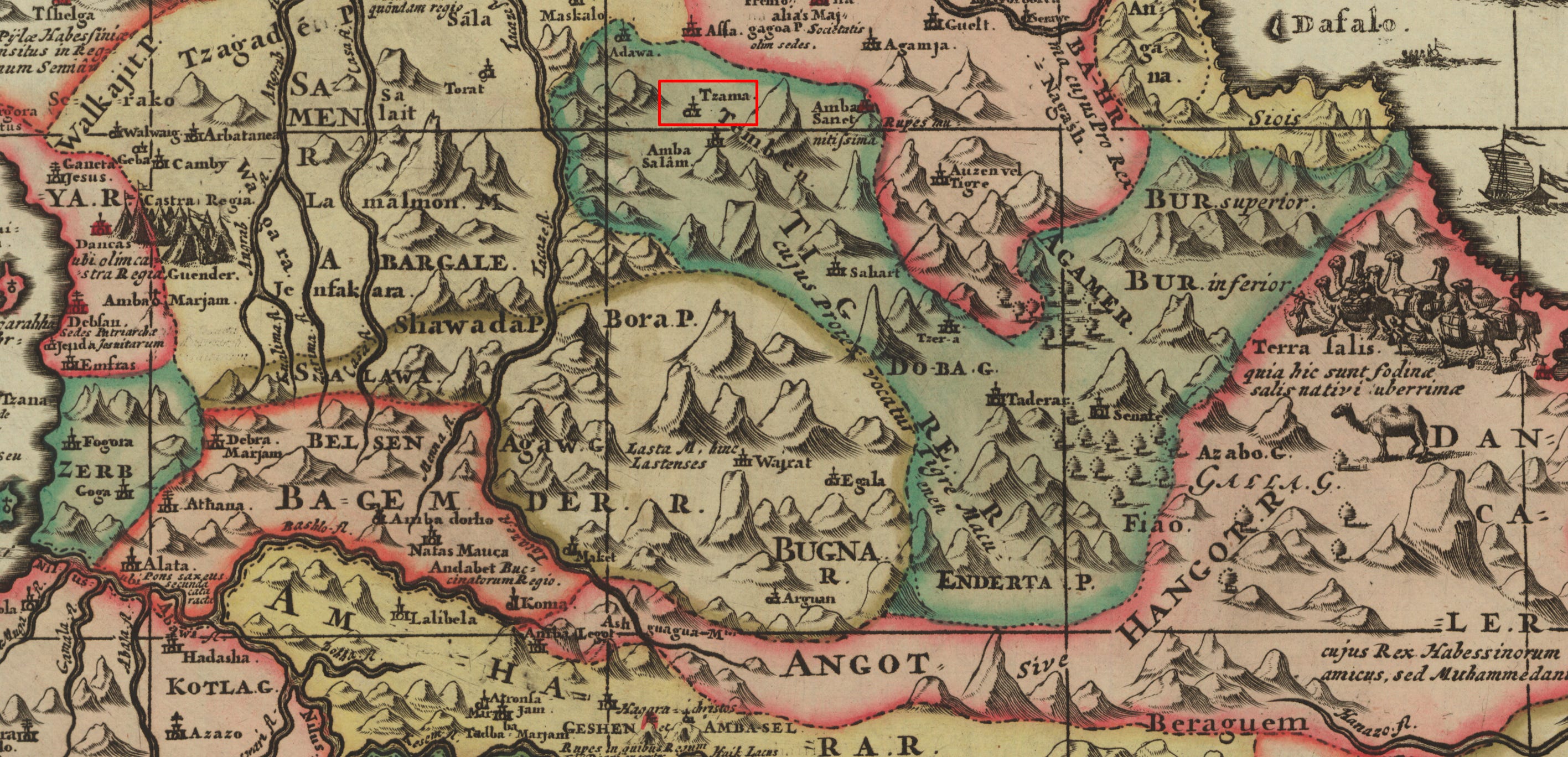
Regarding Angabe, we can likewise only speculate. Salt mentions a place called Angabet (or Andabet) in Begemder47, near the Gondar region. Kalaa, however, remains entirely unidentified. Salt does associate it with a location called Salat, which Ludolf’s map places in the Sémen Mountains. This would be consistent with the next people listed in the inscription, the Semenoi, clearly a reference to the inhabitants of the Sémen Mountains.
Interestingly, the Beta Israel (who lived in the Semien region) are referred to as “Kayla” (similar to Kaala) in some medieval Solomonic era manuscripts, particularly during the Gondarian period, although this may be a later attribution48.
The regions of Samen, Salait, Bugna, Agaw and Andabet is highlighted in this snippet of a map of Abyssinia by Ludolf & Gorgoryos, 1683. Source
The phrase “beyond the Nile” likely refers to crossing one of the branches of the Täkkäze River to get to the Sémen Mountains. The mention of frost and deep snow supports the conclusion that this campaign took place in the Sémen Mountains. Although snowfall there today is minimal, in the 2nd century AD, during the time of these conquests, the climate was likely colder, explaining the description of ‘snow reaching a man’s knees’.
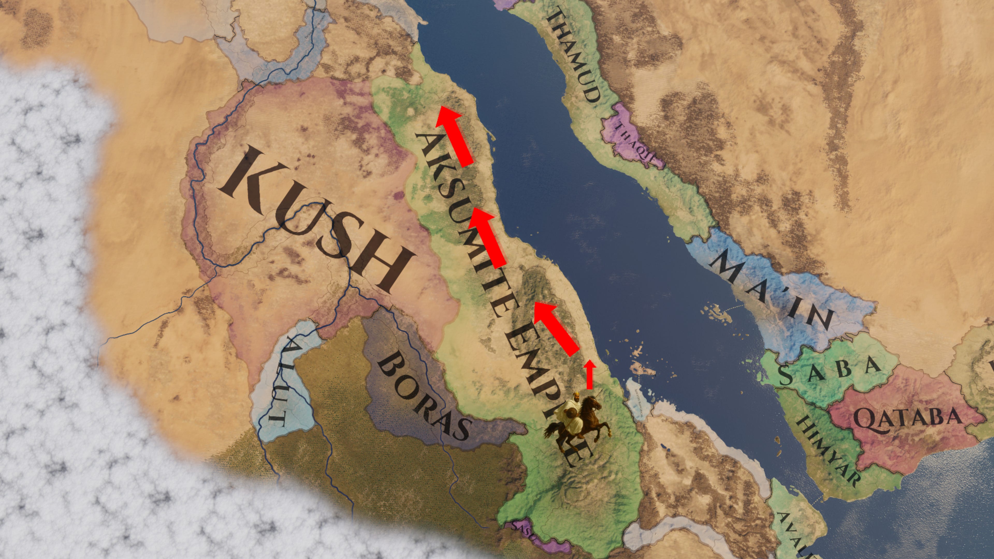
Conquests Of The North - Beja & surrounding territories.
The fourth phase of conquests recorded in the Monumentum Adulitanum II. Own work.
After conquering the Sémen Mountains, the conqueror and his army likely paused to rest, resupply, and consolidate their previous gains, given the challenging terrain and resistance from the local population. Also, the fact that the next series of conquests occurred much further north, beyond already subdued territories and even past Aksum, supports this theory.
“I next subdued Lazine and Zaa and Gabala, tribes which inhabit mountains with steep declivities abounding with hot springs, the Atalmo and Bega, and all the tribes in the same quarter along with them. I proceeded next against the Tangattae, who adjoin the borders of Egypt; and having reduced them I made a footpath giving access by land into Egypt from that part of my dominions.” - Cosmas Indicopleustes, Christian Topography (1897) pp. 23-90. Book 2, section 142
The nations of Lazine, Zaa, and Gabala remain obscure to us. However, an educated guess can be made based on two key details from the inscription. First, it describes these people as inhabiting mountainous regions with steep declivities (κατάρρυτος – meaning sloping or flowing downward49), suggesting a sharp descent towards the lowlands. Second, the areas are noted for their hot springs and are stated before the mention of the Beja people; therefore, they likely lie near the Beja people (referred to as "Bega" in the text).
These clues point to a region in central to north-eastern Eritrea, likely within the Senhit and Sahel provinces (Parts of modern-day Semienawi Kayih Bahri & Anseba). For example, the southern Senhit area contains hot springs such as Maiwooi50, which align well with the inscription’s description. It is therefore quite plausible that the peoples of Lazine, Zaa, and Gabala once lived in this region, extending northwards towards the Atalmo and Beja territories.
The location of five hot springs in Eritrea. Maiwooi and Akwar from Location 1 (Ghtelai area); Garbanabra and Gelti from Location 2 (Irafayle) and Elegedi from Location 3 (Alid area). Source
Scholar Sergew Hable Selassie further suggests that Lazine, Zaa, and Gabala correspond to areas inhabited today by the Mensa (Tigrē) and Habab (Tigrē) tribes51, also known as the Habab region.
In the chronicles of Amda Seyon Conquests, the Gabal are located in the north-eastern part of Endarta in Tigray. G. W. B. Huntingford further observes that “Gabala may be Kabalé (Raheita)”52, most likely referring to a location near Rehayto, a town in the Southern Red Sea region of modern Eritrea, near the Djibouti border.
The Atalmo nation remains unidentified, but it likely lay just south of the Beja territories, as it is mentioned preceding them. The "Bega" is undoubtedly a reference to the Beja, who were also known as the Blemmyes in antiquity. They inhabited a broad region along the Red Sea coast in what is now Sudan, extending as far north as Berenike in Egypt53. The Tangattae were a Beja tribe54.
Once again, the 11th-century copies of Cosmas’s manuscript provide marginal notes offering additional insight into this particular section of the inscription:
οὓς Βλέμμυας οὕτως καλοῦσιν οἱ Αἰθίοπες· τοὺς Ταγγαΐτας καλεῖ τοὺς Ἀτταβίτη καὶ τοὺς Ἀδρα → “Thus the Aethiopians call the Blemmyes. He refers to the Tangaitai as the Attabitae and the Adra”55.
This footnote further reinforces the identification of the Bega with the Beja people, as Blemmyes is the Greco-Roman term commonly used for the Beja during antiquity. The Attabitae and Adra nations are unknown.
Two Beja men in the Early Modern Period - The Ababda, Nomads of the Eastern Thebaid Desert, illustration from The Valley of the Nile. Source
Conquests Of Barbaria
The fifth phase of conquests recorded in the Monumentum Adulitanum II. Own work.
“Next I reduced Annine and Metine — tribes inhabiting precipitous mountains. My arms were next directed against the Sesea nation. These had retired to a high mountain difficult of access; but I blockaded the mountain on every side, and compelled them to come down and surrender. I then selected for myself the best of their young men and their women, with their sons and daughters and all besides that they possessed. The tribes of Rhausi I next brought to submission: a barbarous race spread over wide waterless plains in the interior of the frankincense country. [Advancing thence towards the sea] I encountered the Solate, whom I subdued, and left with instructions to guard the coast. All these nations, protected though they were by mountains all but impregnable, I conquered, after engagements in which I was myself present. Upon their submission I restored their territories to them, subject to the payment of tribute. Many other tribes besides these submitted of their own accord, and became likewise tributary. - Cosmas Indicopleustes, Christian Topography (1897) pp. 23-90. Book 2, section 142 & 143
The nation of Annine remains unidentified by modern scholars. The only detail provided is that they inhabited (δυσβατώτατον - hard to traverse/precipitous56) mountains, suggesting a rugged, mountainous terrain with cliffs adjacent to the lowlands. Since the subsequent conquests described in the text occur in the northern Somaliland and Djibouti region, these tribes must have lived further north, placing them possibly in the Dobe’a region of medieval Abyssinia (around the present-day Afar and south-east Tigray area).
The Metine are mentioned in an Aksumite-era inscription in connection with a place called HMS, which may represent an unvocalised form of Hamasen, a medieval province in the northern Eritrean highlands57.
“...Next he came to HMS and there came all the tribes of Metin and he received his submission and let them return to their own country...” - Aksum: an African civilisation of late antiquity, pg 223.
The region of Dobe’a is highlighted in this snippet of a map of Abyssinia by Ludolf & Gorgoryos, 1683. Source
Next, he conquered the Sesea nation, which refers to tribes located within Barbaria ( modern-day northern Somaliland). This is confirmed by the 11th-century footnote: "Σέσεα ἔθνος ἐπολέμησα. Τὰ τῆς Βαρβαρίας ἔθνη ἐνταῦθα δηλοί." → "I waged war against the Seasea nation. Here, he clearly refers to the tribes of Barbaria”58.
There may be an etymological link between the Sesea and the Issa clan of Somalia59, who continue to inhabit northern Somaliland to this day.
Among the first of these tribes he encountered was the Rhausi, one of the inland peoples of Barbaria. They dwelled in arid plains, likely referring to the desert lowlands of the frankincense country (interior Somaliland). Controlling these tribes would have had significant economic importance, as frankincense was one of the most valuable trade commodities of the ancient world.
After his inland campaigns, the emperor turned back toward the coast and subdued Solate, a polity possibly located along the Somaliland coastline.
This section of the inscription also offers rare insight into the emperor's military strategies. For instance, he is said to have blockaded enemy tribes who had taken refuge in the mountains, starving them into surrendering. He also integrated the finest soldiers from conquered peoples into his own forces, simultaneously strengthening his military in addition to beginning the process of assimilating new groups into the empire.
Finally, the mention of imposing tributary status, rather than direct rule, suggests that local power structures were not entirely dismantled; rather, they were redirected to serve the emperor's authority, as was the case with the Solate.
Berbera, on the Somali Coast (litho) by Wright, Henry Charles Seppings (1850-1937). Source
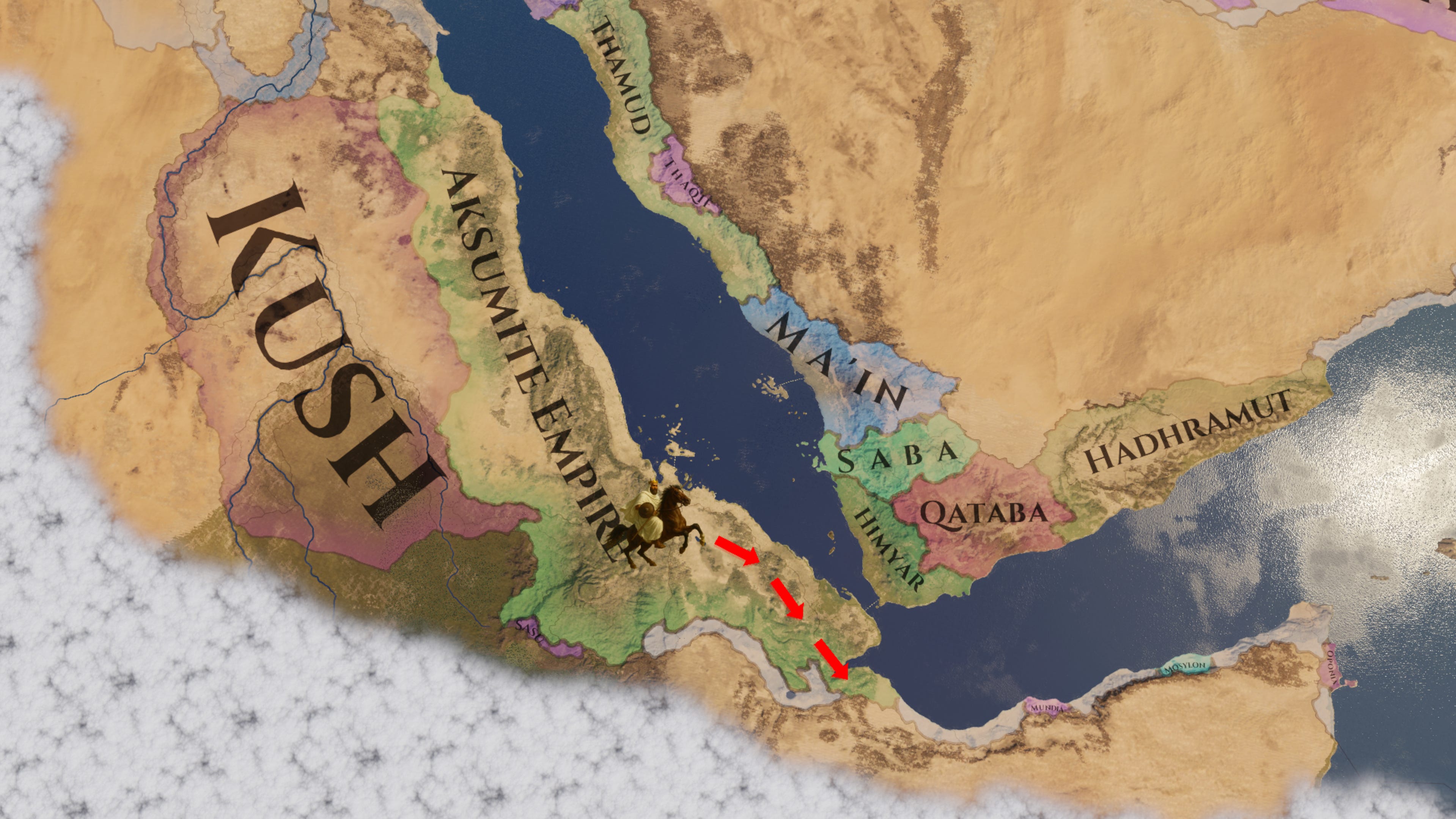
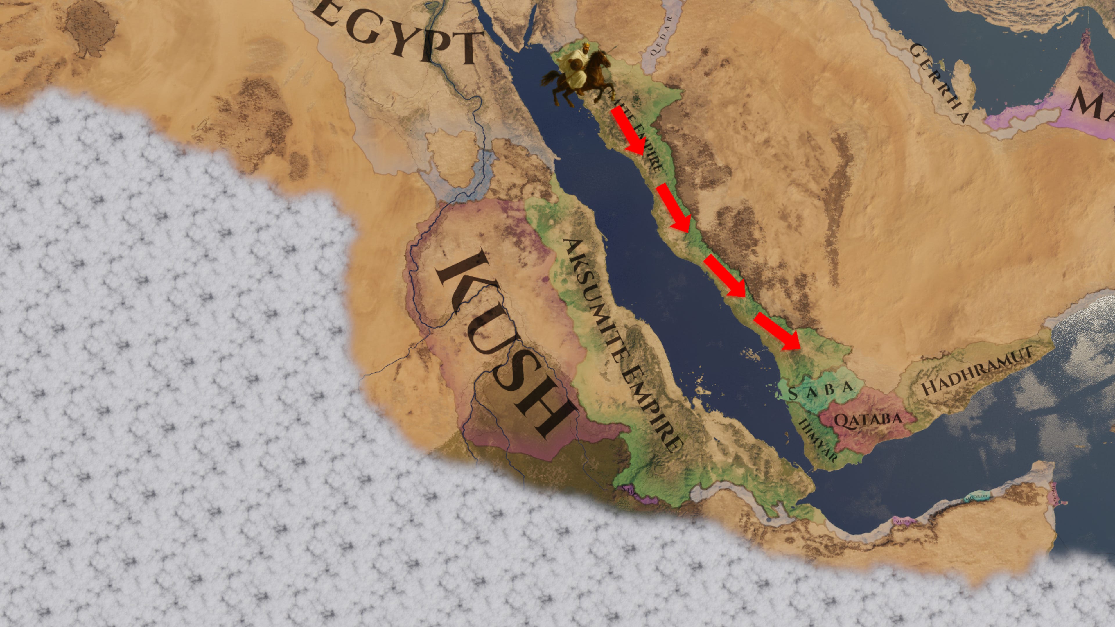
Conquests Of Arabia
The last phase of conquests recorded in the Monumentum Adulitanum II. Own work.
The final section of the Monumentum Adulitanum II describes the conqueror’s campaigns in Arabia, specifically on the coastline of present-day Saudi Arabia.
“And I sent a fleet and land forces against the Arabitae and Cinaedocolpitae who dwelt on the other side of the Red Sea, and having reduced the sovereigns of both, I imposed on them a land tribute and charged them to make travelling safe both by sea and by land. I thus subdued the whole coast from Leuce Come to the country of the Sabaeans. I first and alone of the kings of my race made these conquests. For this success I now offer my thanks to my mighty God, Ares, who begat me, and by whose aid I reduced all the nations bordering on my own country, on the East to the country of frankincense, and on the West to Ethiopia and Sasu. Of these expeditions, some were conducted by myself in person, and ended in victory, and the others I entrusted to my officers. Having thus brought all the world under my authority to peace, I came down to Aduli and offered sacrifice to Zeus, and to Ares and to Poseidon, whom I entreated to befriend all who go down to the sea in ships. Here also I reunited all my forces, and setting down this Chair in this place, I consecrated it to Ares in the twenty-seventh year of my reign.” - Cosmas Indicopleustes, Christian Topography (1897) pp. 23-90. Book 2, section 143
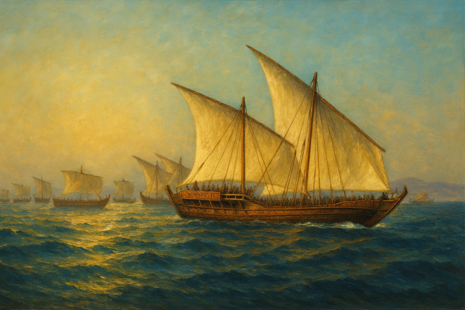
A combined fleet and land force was required to cross the Erythraean Sea, with the ships likely based at Gabaza, the port of Adulis. The inscription records the conquest of two Arabian tribes: the Arabitae and the Cinaedocolpitae, whose locations are identified through Ptolemy’s Geography and explanatory notes preserved in 8th- and 11th-century manuscript copies of Cosmas Indicopleustes’ book.
The Tihāmah regions, specifically Tihama Hijaz, are likely where the conquests of Monumentum Adulitanum II occurred. Source
According to Ptolemy60, the Cinaedocolpitae occupied the north-central Arabian coastline (specifically 90km north of present-day Mecca61), while the Arabitae formed part of Arabia Felix, in what is now western central Arabia. In other words, much of the Tihāmah region north of Saba was likely brought under the control of the Aksumites, which is a view supported by scholars such as Sergew Hable Selassie62, I︠U︡riĭ Mikhailovich Kobishchanov63, and G. W. Bowersock64.
This theory is reinforced by the 8th-century manuscript (Vat. gr. 699), which has a footnote that states65: “Ἀρραβίτας καὶ Κιναιδοκολπίτας τοὺς εἰς τὸν Ὁμηρίτην σημαίνει, τουτέστι τοὺς ἐν τῇ Εὐδαίμονι Ἀρραβίᾳ” (“By ‘Arabitae’ and ‘Cinaedocolpitae’ he means those in the land of the Homerites, that is, those in Arabia Felix”). Likewise, the 11th-century manuscript includes a footnote that states66: “Here, he calls the Homerites ‘Arabites’, and the coastal Adonites he calls ‘Cinaedocolpitae’”.
South Arabian inscription resembling Ge’ez – Al-Nahlaa Rock, located in the Tayma Oasis. Source: @DerilloEyob on Twitter.
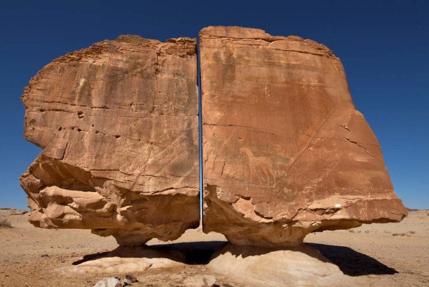
Interestingly, cave paintings featuring scripts resembling Ge’ez have been discovered in north-eastern Saudi Arabia, such as the inscriptions at Tayma. This may indicate a possible presence of Aksumite or pre-Aksumite peoples in the general area.
Split rock as if cut by a razor, Tayma. Source: Mysteries and Mysticism in the Arabian Desert, Figure 2.
The inscription also references Leuce Come, a well-known Nabataean port situated at the northernmost tip of the Red Sea (The Nabataean kingdom was conquered by Rome in 106 AD)67. Therefore, the conquests attributed to the Emperor imply that all territory between Roman Leuce Come and Saba became tributary to him. As a result, all trade passing through these lands would have been taxed, elevating his empire to the dominant maritime power in the Erthraean Sea and giving it control over the majority of regional trade.
Alliance with the Roman Empire?
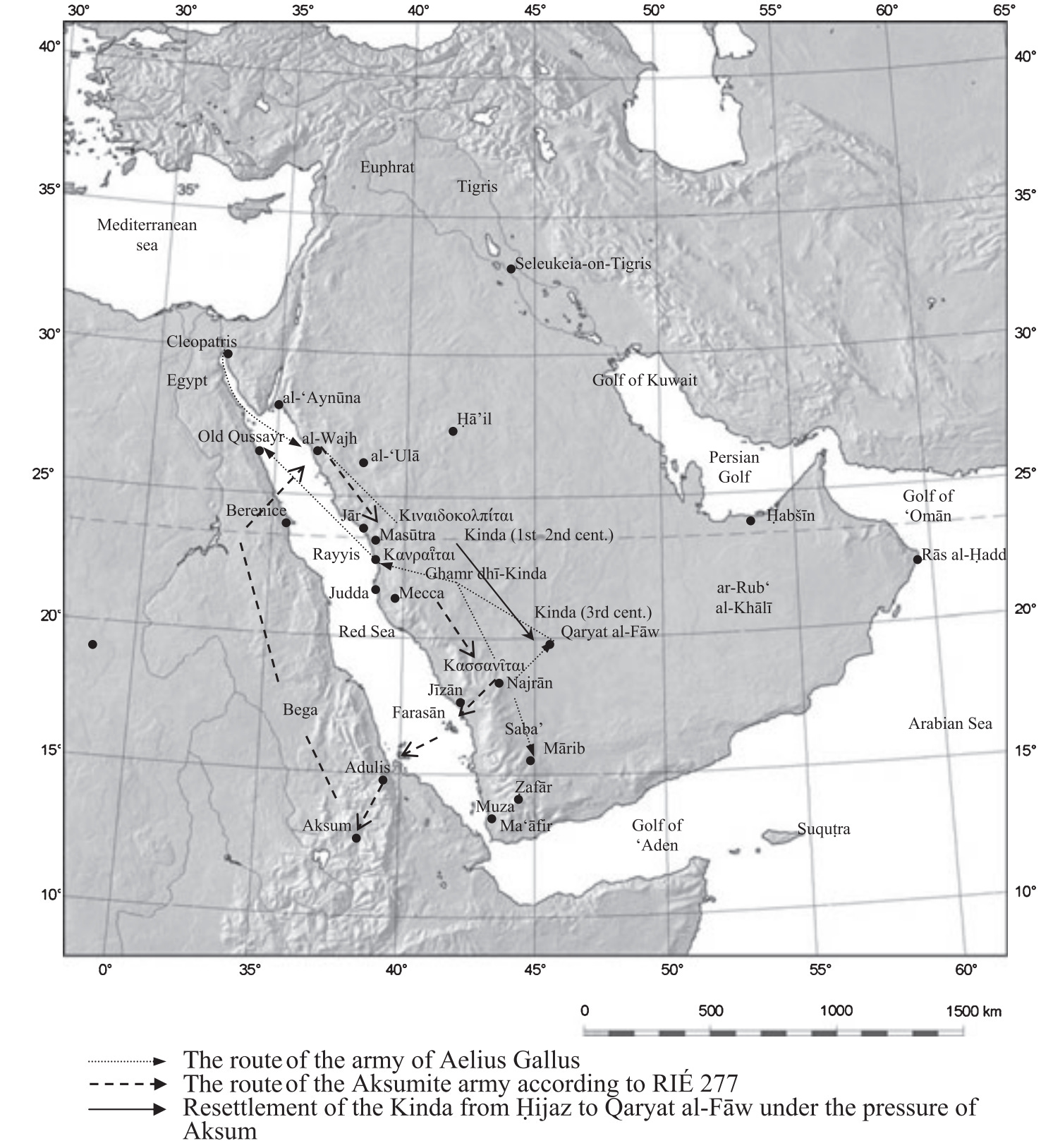
Proposed route (dotted arrow) taken by the conqueror mentioned in Monumentum Adulitanum II during his campaigns in South Arabia. Source: Towards the earliest history of Kinda Fig. 1
Scholar Mikhail D. Bukharin68 argues that one of the key motives for the invasion of the South Arabian coastline was to aid the Roman Empire in suppressing disruptions to Red Sea trade. He cites a passage from the Periplus of the Erythraean Sea describing a group called the Carnaites (who he identifies with the Cinaedocolpitae) who are described as engaging in raids, kidnapping, and the enslavement of merchants.:
“Directly below this place is the adjoining country of Arabia, in its length bordering a great distance on the Erythraean Sea. Different tribes inhabit the country, differing in their speech, some partially, and some altogether. The land next the sea is similarly dotted here and there with caves of the Fish-Eaters, but the country inland is peopled by rascally men speaking two languages, who live in villages and nomadic camps, by whom those sailing off the middle course are plundered, and those surviving shipwrecks are taken for slaves. And so they too are continually taken prisoners by the chiefs and kings of Arabia; and they are called Carnaites.” - Periplus of the Erythraean Sea, section 20
The final section of the inscription reaffirms the extent of his empire, specifically noting that it stretched westward, bordering both Ethiopia and Sasu. Eastwards it reached the `country of frankincense` (Barbaria /Somaliland).
In the geographical understanding of the time, “Ethiopia” referred to regions encompassing Sudan and parts of present-day Eritrea and Ethiopia. In the context of this inscription, it likely refers to the areas around Meroë, while “Sasu” likely lay further south, in territories corresponding to modern central and southern Ethiopia69.
Colourisation of a sketch ‘An Aksumite naval expedition crossing the Red Sea to South Arabia’. Source: A history of Ethiopia in pictures, from Ancient to Modern Times, pg 17.
It also records that the conqueror descended to Adulis, where, following his successful campaigns, he assembled his army. There, he commissioned the construction of a throne beside the stela commemorating the conquests of Ptolemy III, thereby linking his own achievements to those of the Ptolemies and, by extension, to Alexander the Great, founder of the Ptolemaic dynasty.
The closing lines of the inscription convey thanks to the gods Ares, Zeus, and Poseidon. In Aksumite tradition, these deities would be locally associated with Mahrem (Ares, god of war70), Baher (Poseidon, god of the sea71), and Astar (Zeus, a sky deity72).
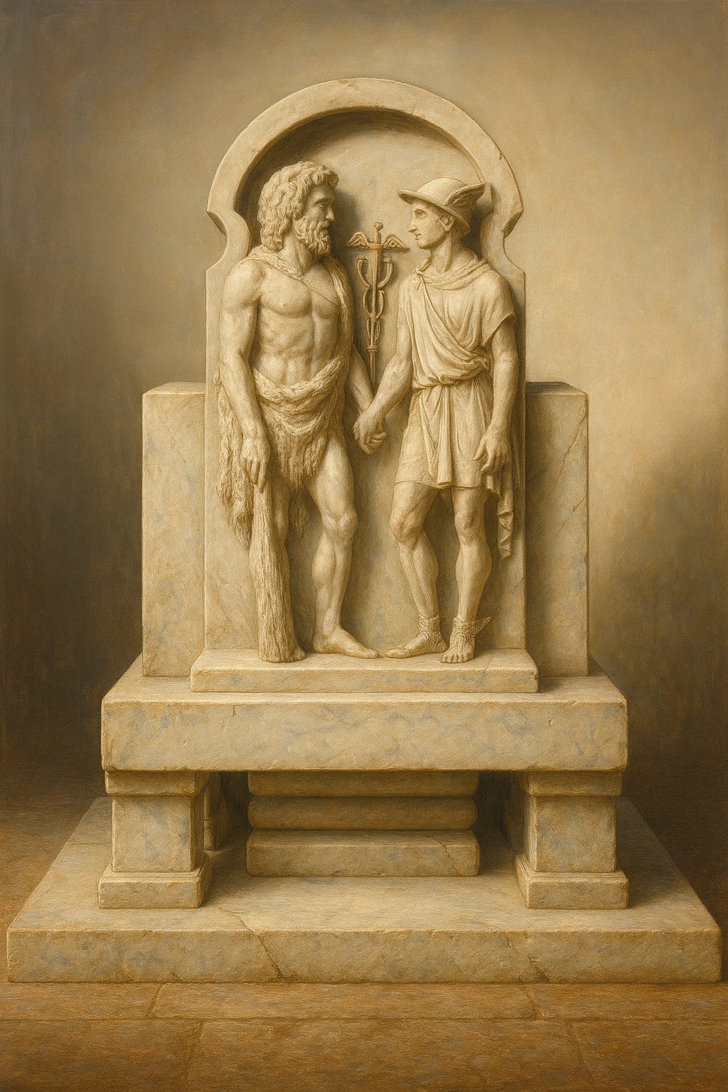
The back of the Adulis Throne, featuring engravings of Heracles and Hermes, as described by the 6th-century traveller Cosmas Indicopleustes. Own Work
Conclusion
So as we move into the early third century AD, the South Arabian inscription Ja 56773 records the name of Emperor GDRT, ruler of the Ḥabashat and the Aksumites. He would be the first in a line of emperors in the third century to intervene in South Arabian affairs. That, however, is a story for another time. For now, we can see that the conquests described in the Monumentum Adulitanum II were essential in uniting the highlands of Eritrea and Ethiopia, laying the foundation for the Aksumite Empire’s eventual rise in influence across much of the Erythraean Sea.
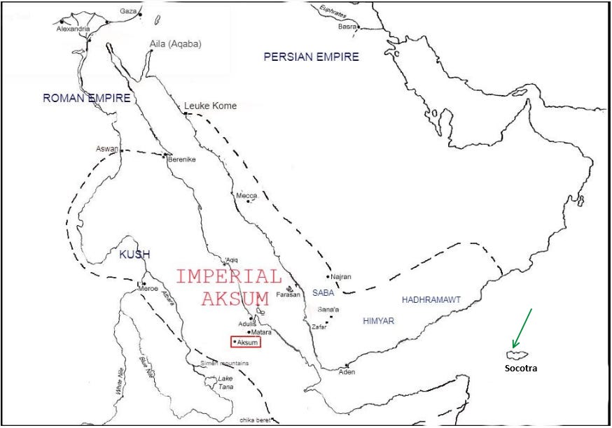
Approximate extent of the Aksumite Empire’s influence during the 3rd–6th centuries AD. (Meroë/Kush would not be conquered until the late 3rd century, and South Arabia would only fall fully under Aksumite control in the 6th century; thus this map only illustrates the sphere of influence during this earlier period). Source: African History Extra.


