
Landscapes and Landforms of Ethiopia — illustration 1, PDF page 135
Source record
- Source
- Habesha History book corpus — Landscapes and Landforms of Ethiopia
- Book
- Landscapes and Landforms of Ethiopia
- Source reference
- Landscapes and Landforms of Ethiopia; PDF page 135; embedded illustration 1, exact source rectangle 183.41, 59.53, 544.37, 586.33
- Page
- 135
- Publication year
- 2015
- Type
- Book illustration
Date of image not recorded.
Creator not recorded.
Source-book and PDF-page attribution only. No place, subject, creator or image date is inferred from nearby body text or the publication date.
Source-page captions
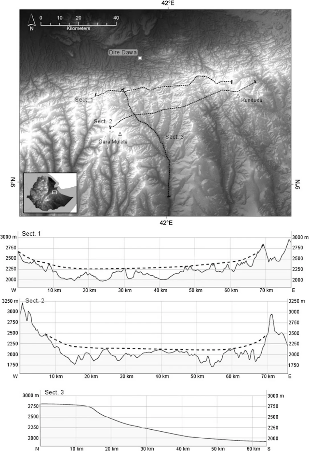
Fig. 5.16 A rectangular pattern influenced by faults is recognizable in the Dire Dawa area, to the north of the watershed, marked by Sect. 1. A straight southward-oriented drainage is recognizable to the south. The latter is associated with the continuation of a valley that was beheaded by the activation of the fault escarpment. A larger palaeovalley at higher elevation on the watershed was already modelled over the basement and the pre-Oligocene sedimentary sequence (Sect. 1). It is also well recognizable slightly to the south from Sect. 2 where the higher part of the slope is modelled over the CFB. The flat upper part of the longitudinal profile of the river is influenced by the original palaeovalley before beheading, while the lower tract is due to headward erosion
Illustration from the identified source publication. Captions on the source page are preserved separately and are not asserted to belong to this individual crop. Publication year is not the image date.
Image rights
Original publication and credited image creators retain their rights. No open licence has been established for this corpus copy.
User-confirmed permission to use images in the local Habesha History corpus, 2026-09-28; this does not grant visitors a general reuse licence.
Request image removal