
Landscapes and Landforms of Ethiopia — illustration 1, PDF page 145
Source record
- Source
- Habesha History book corpus — Landscapes and Landforms of Ethiopia
- Book
- Landscapes and Landforms of Ethiopia
- Source reference
- Landscapes and Landforms of Ethiopia; PDF page 145; embedded illustration 1, exact source rectangle 53.86, 274.96, 541.54, 649.84
- Page
- 145
- Publication year
- 2015
- Type
- Book illustration
Date of image not recorded.
Creator not recorded.
Source-book and PDF-page attribution only. No place, subject, creator or image date is inferred from nearby body text or the publication date.
Source-page captions
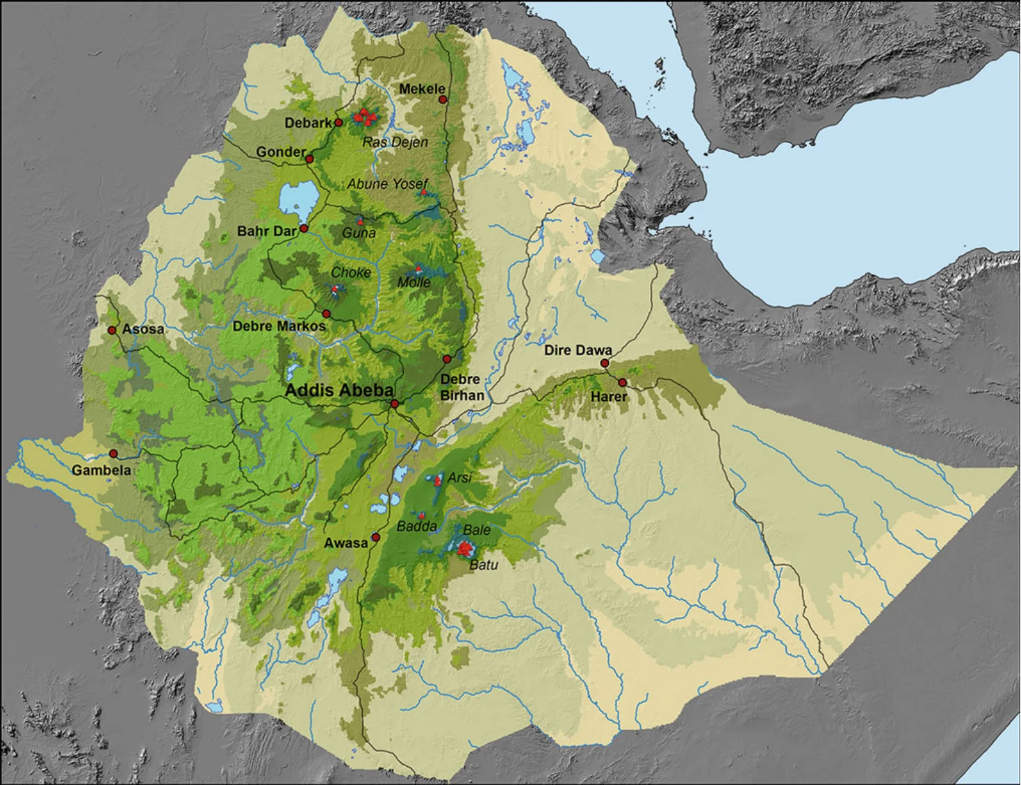
Figure 6.1 presents an overview of Ethiopian mountain tops above 4,000 m asl. The minimum height of 4,000 m asl is taken because mountain tops with lower altitudes do gen- erally not show paleoglaciation features. In addition, the extent of the Ethiopian Highlands is also given, according to its agroecological belts (from Kolla, Weyna Dega and Dega to Wurch, cf. Hurni 1998).
Fig. 6.1 Overview of mountain tops higher than 4,000 m asl in the Ethiopian Highlands, all with paleo-periglaciation and some with paleoglatiation features. The country is coloured according to agro- ecological belts: semi-arid lowlands are yellow to brownish (Berha, i.e. below about 1,000 m asl); sub-humid to humid highlands are olive to
Illustration from the identified source publication. Captions on the source page are preserved separately and are not asserted to belong to this individual crop. Publication year is not the image date.
Image rights
Original publication and credited image creators retain their rights. No open licence has been established for this corpus copy.
User-confirmed permission to use images in the local Habesha History corpus, 2026-09-28; this does not grant visitors a general reuse licence.
Request image removal