
Landscapes and Landforms of Ethiopia — illustration 1, PDF page 146
Source record
- Source
- Habesha History book corpus — Landscapes and Landforms of Ethiopia
- Book
- Landscapes and Landforms of Ethiopia
- Source reference
- Landscapes and Landforms of Ethiopia; PDF page 146; embedded illustration 1, exact source rectangle 53.86, 374.74, 541.54, 668.14
- Page
- 146
- Publication year
- 2015
- Type
- Book illustration
Date of image not recorded.
Creator not recorded.
Source-book and PDF-page attribution only. No place, subject, creator or image date is inferred from nearby body text or the publication date.
Source-page captions
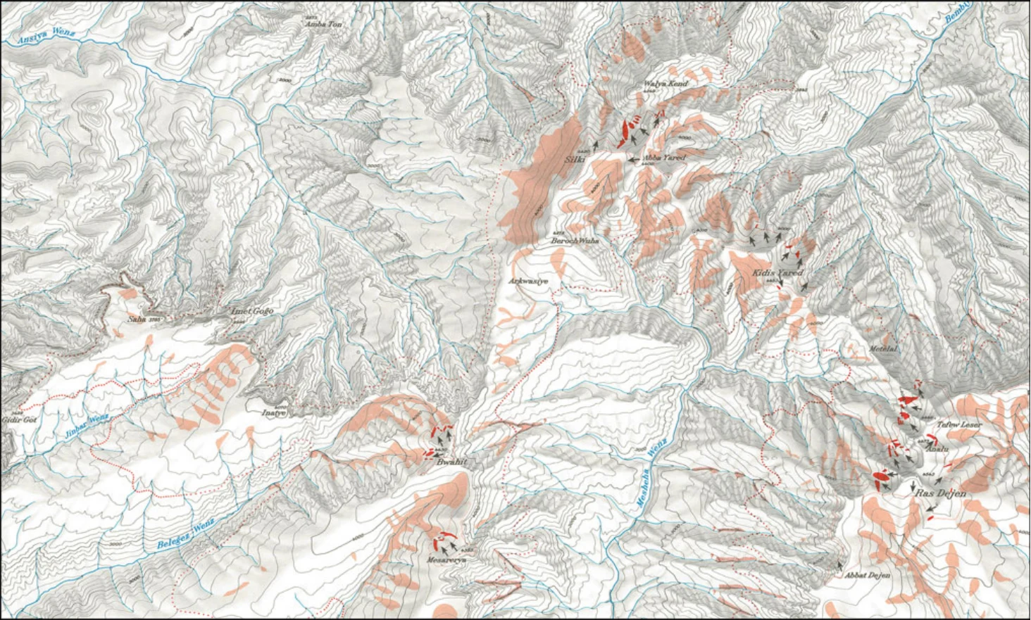
Figure 6.2 gives a section from the map 1:100,000 by Hurni (1981) with all moraines he detected in Simen during field- work in 1974–1977, and Fig. 6.3 is a photograph of the largest moraine found in the westerly catchment of Ras Dejen, below a cirque that steeply descends into the Mesheha Valley.
Figure 6.4 presents an analysis of all paleoglacial moraines observed in Simen by Hurni (1982) and includes the most important characteristics and parameters, such as the paleosnow- line and the lower limit of the paleo-periglacial slope deposits.
Fig. 6.2 Mountain tops in Simen with paleoglaciation features of the last cold period. Features presented are moraines (full red) with ice flow direction (black arrows); periglacial slope deposits (pale red), and snowline (red dotted). East–West distance is about 36.5 km. Source section of map by Hurni (1981)
Illustration from the identified source publication. Captions on the source page are preserved separately and are not asserted to belong to this individual crop. Publication year is not the image date.
Image rights
Original publication and credited image creators retain their rights. No open licence has been established for this corpus copy.
User-confirmed permission to use images in the local Habesha History corpus, 2026-09-28; this does not grant visitors a general reuse licence.
Request image removal