
Landscapes and Landforms of Ethiopia — illustration 1, PDF page 225
Source record
- Source
- Habesha History book corpus — Landscapes and Landforms of Ethiopia
- Book
- Landscapes and Landforms of Ethiopia
- Source reference
- Landscapes and Landforms of Ethiopia; PDF page 225; embedded illustration 1, exact source rectangle 184.33, 59.53, 544.33, 314.17
- Page
- 225
- Publication year
- 2015
- Type
- Book illustration
Date of image not recorded.
Creator not recorded.
Source-book and PDF-page attribution only. No place, subject, creator or image date is inferred from nearby body text or the publication date.
Source-page captions
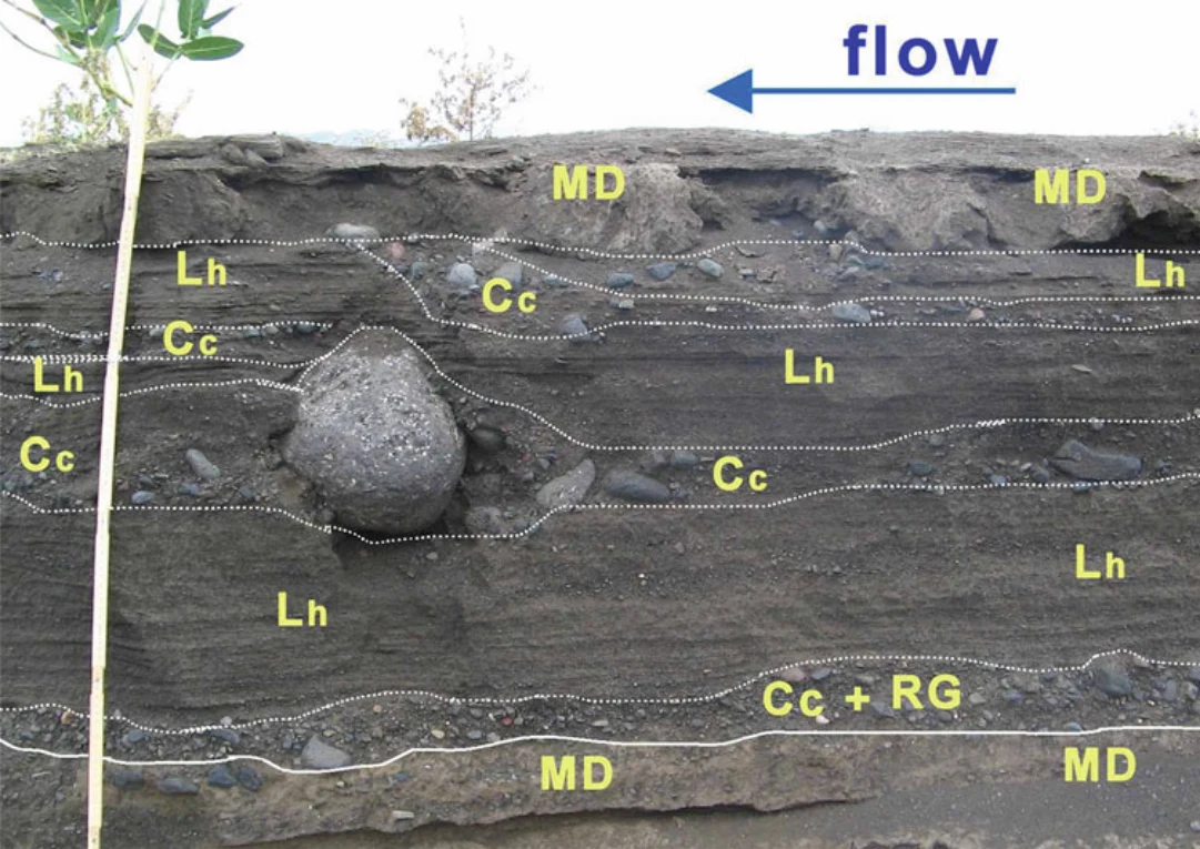
Fig. 12.16 Application of the division classification model to a stratigraphic log of a modern streambed cut bank of the Mersa River. Horizontally laminated and massive sand in the vicinity of larger particles show no flow perturbation features such as scour holes or lee side fine- grained wake. Division notation: Cc coarse core division; Lh horizontal lamination; MD mud drape; RG reverse grading. The stick ruler for scale is about 90 cm long
Fig. 12.17 Sketch model of the typical division arrangement within an individual layer (from Billi 2008—modified)
Illustration from the identified source publication. Captions on the source page are preserved separately and are not asserted to belong to this individual crop. Publication year is not the image date.
Image rights
Original publication and credited image creators retain their rights. No open licence has been established for this corpus copy.
User-confirmed permission to use images in the local Habesha History corpus, 2026-09-28; this does not grant visitors a general reuse licence.
Request image removal