
Landscapes and Landforms of Ethiopia — illustration 1, PDF page 254
Source record
- Source
- Habesha History book corpus — Landscapes and Landforms of Ethiopia
- Book
- Landscapes and Landforms of Ethiopia
- Source reference
- Landscapes and Landforms of Ethiopia; PDF page 254; embedded illustration 1, exact source rectangle 195.82, 70.28, 532.82, 424.55
- Page
- 254
- Publication year
- 2015
- Type
- Book illustration
Date of image not recorded.
Creator not recorded.
Source-book and PDF-page attribution only. No place, subject, creator or image date is inferred from nearby body text or the publication date.
Source-page captions
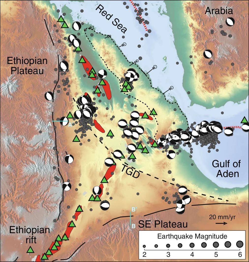
Fig. 15.2 Tectonic setting of the Afar Depression (modified after Keir et al. 2011). Solid black lines show Oligocene–Miocene border faults of the Red Sea, Gulf of Aden and East African rifts. Red segments show the Quaternary– Recent subaerial rift axes, and green triangles show Holocene volcanoes. Dashed lines show the Tendaho–Goba’ad Discontinuity (TGD). Gray circles show large earthquakes during 1973–2012 sourced from the National Earthquake Information Centre (NEIC) catalogue. Earthquake focal mechanisms are from the Global Centroid Moment Tensor (CMT) catalogue. The black dashed line defines the boundaries of the Danakil microplate. The arrows show the motion of the Danakil microplate (McClusky et al. 2010). Cyan lines with letters indicate the traces of cross sections illustrated in Fig. 15.3
Illustration from the identified source publication. Captions on the source page are preserved separately and are not asserted to belong to this individual crop. Publication year is not the image date.
Image rights
Original publication and credited image creators retain their rights. No open licence has been established for this corpus copy.
User-confirmed permission to use images in the local Habesha History corpus, 2026-09-28; this does not grant visitors a general reuse licence.
Request image removal