
Landscapes and Landforms of Ethiopia — illustration 1, PDF page 303
Source record
- Source
- Habesha History book corpus — Landscapes and Landforms of Ethiopia
- Book
- Landscapes and Landforms of Ethiopia
- Source reference
- Landscapes and Landforms of Ethiopia; PDF page 303; embedded illustration 1, exact source rectangle 53.86, 59.53, 541.54, 257.77
- Page
- 303
- Publication year
- 2015
- Type
- Book illustration
Date of image not recorded.
Creator not recorded.
Source-book and PDF-page attribution only. No place, subject, creator or image date is inferred from nearby body text or the publication date.
Source-page captions
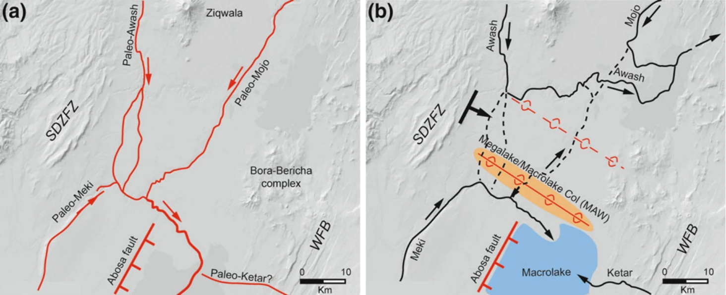
Fig. 17.13 Palaeohydrography north of Lake Ziway. a The regional drainage during the Late Reduced Lakes phase (latest Pleistocene) toward the desiccated lake basin, a condition that dominated also during the Megalake phase and ensured high water supply to the lakes. The Abosa fault may have been active during these stages making the central portion of the basin actively subsiding. WFB Wonji Fault Belt; SDZFZ Silti-Debre Zeyt Fault Zone. Present Lake Ziway and Koka Reservoir for reference. b Around the Pleistocene–Holocene transition, the possibly concurrent activity of the Abosa fault and of the transverse
Illustration from the identified source publication. Captions on the source page are preserved separately and are not asserted to belong to this individual crop. Publication year is not the image date.
Image rights
Original publication and credited image creators retain their rights. No open licence has been established for this corpus copy.
User-confirmed permission to use images in the local Habesha History corpus, 2026-09-28; this does not grant visitors a general reuse licence.
Request image removal