
Landscapes and Landforms of Ethiopia — illustration 1, PDF page 330
Source record
- Source
- Habesha History book corpus — Landscapes and Landforms of Ethiopia
- Book
- Landscapes and Landforms of Ethiopia
- Source reference
- Landscapes and Landforms of Ethiopia; PDF page 330; embedded illustration 1, exact source rectangle 53.92, 59.53, 541.59, 517.93
- Page
- 330
- Publication year
- 2015
- Type
- Book illustration
Date of image not recorded.
Creator not recorded.
Source-book and PDF-page attribution only. No place, subject, creator or image date is inferred from nearby body text or the publication date.
Source-page captions
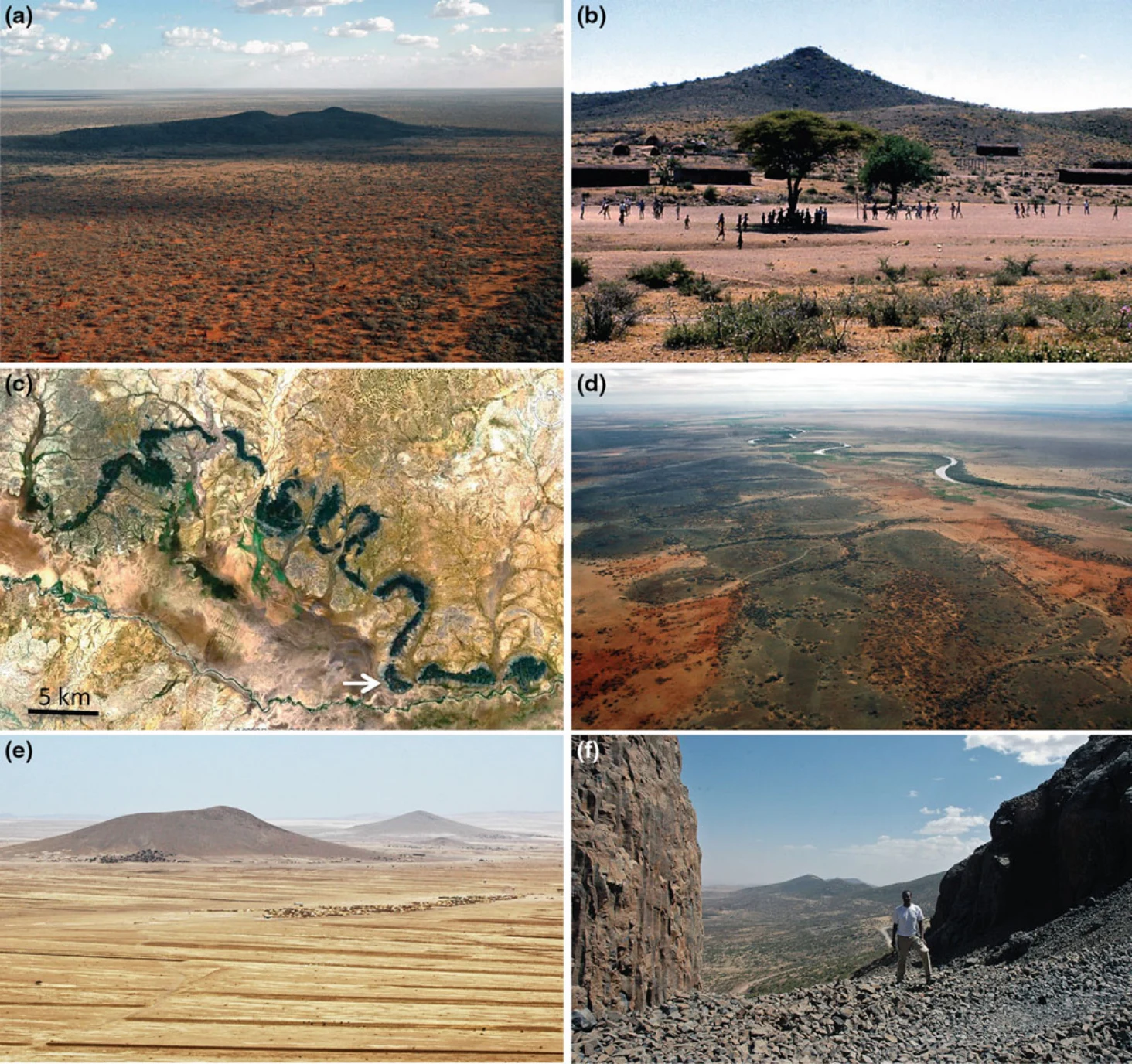
Fig. 19.8 Selected volcanic landforms of the Ogaden. a Ilbah Hills, a dyke-related volcanic complex in east central Ogaden; b volcanic hills near Fik town; c part of a Landsat ETM+ image (Geocover 2000) of basalt hills formed by inversion of canyon-filling lava flows in the ancestral Shebele river. Arrow shows direction of view in (d); d Wabe
Illustration from the identified source publication. Captions on the source page are preserved separately and are not asserted to belong to this individual crop. Publication year is not the image date.
Image rights
Original publication and credited image creators retain their rights. No open licence has been established for this corpus copy.
User-confirmed permission to use images in the local Habesha History corpus, 2026-09-28; this does not grant visitors a general reuse licence.
Request image removal