
Geo-trekking in Ethiopia's Tropical Mountains: The Dogu'a Tembien District — illustration 1, PDF page 39
Source record
- Source
- Habesha History book corpus — Geo-trekking in Ethiopia's Tropical Mountains: The Dogu'a Tembien District
- Book
- Geo-trekking in Ethiopia's Tropical Mountains: The Dogu'a Tembien District
- Source reference
- Geo-trekking in Ethiopia's Tropical Mountains: The Dogu'a Tembien District; PDF page 39; embedded illustration 1, exact source rectangle 77.22, 62.36, 342.26, 441.24
- Page
- 39
- Publication year
- 2019
- Type
- Book illustration
Date of image not recorded.
Creator not recorded.
Source-book and PDF-page attribution only. No place, subject, creator or image date is inferred from nearby body text or the publication date.
Source-page captions
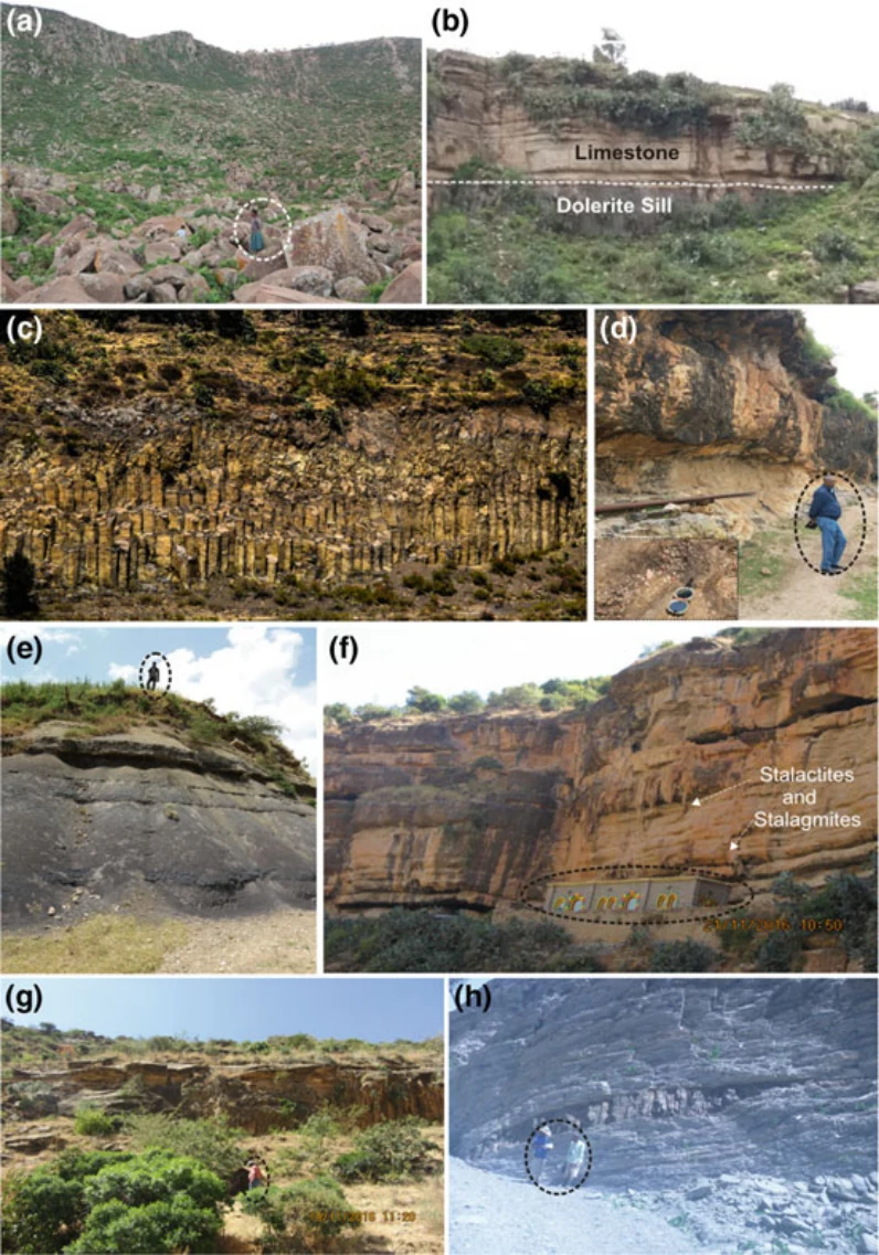
Photo 1.2 Main lithologies of Dogu’a Tembien, including, from more recent to older: a phonolite ridge north of Hagere Selam, b dolerite sill intruding massive cliff-forming limestone, c Hagere Selam columnar basalt at the lower volcanic succession, d cliff-forming Amba Aradam sandstone, inset is pebbly sandstone, e purple colour laminated shale, f lower succession of the Antalo supersequence with stalactites and stalagmites at the cliff surface, g the upper part of Adigrat sandstone, sorted and fine-grained, h basement rocks (slates and phyllites) intruded by Cenozoic intrusives. Persons or building for scale are highlighted. Photos Miruts Hagos
Illustration from the identified source publication. Captions on the source page are preserved separately and are not asserted to belong to this individual crop. Publication year is not the image date.
Image rights
Original publication and credited image creators retain their rights. No open licence has been established for this corpus copy.
User-confirmed permission to use images in the local Habesha History corpus, 2026-09-28; this does not grant visitors a general reuse licence.
Request image removal