
Geo-trekking in Ethiopia's Tropical Mountains: The Dogu'a Tembien District — illustration 1, PDF page 132
Source record
- Source
- Habesha History book corpus — Geo-trekking in Ethiopia's Tropical Mountains: The Dogu'a Tembien District
- Book
- Geo-trekking in Ethiopia's Tropical Mountains: The Dogu'a Tembien District
- Source reference
- Geo-trekking in Ethiopia's Tropical Mountains: The Dogu'a Tembien District; PDF page 132; embedded illustration 1, exact source rectangle 68.01, 62.35, 351.69, 358.67
- Page
- 132
- Publication year
- 2019
- Type
- Book illustration
Date of image not recorded.
Creator not recorded.
Source-book and PDF-page attribution only. No place, subject, creator or image date is inferred from nearby body text or the publication date.
Source-page captions
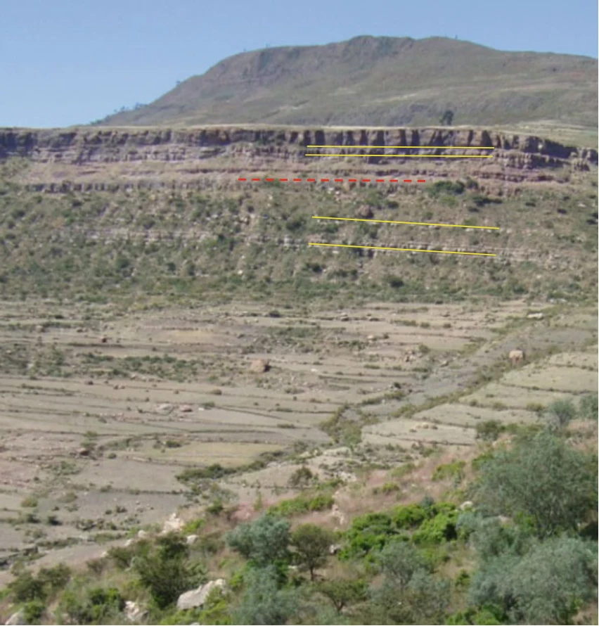
Photo 7.1 The upper sedimentary succession of Antalo limestone (middle of cliff) and the overlying Amba Aradam sandstone (top of cliff) in Harena (looking to the NW). Yellow lines indicate that the sandstone is nearly horizontal, while the limestone is slightly dipping to the right (to the east). This is called an angular unconformity. The red broken line indicates the planation surface PS3 (Chap. 10) that occurred between limestone and sandstone deposition. Photo Jan Nyssen (2008)
Illustration from the identified source publication. Captions on the source page are preserved separately and are not asserted to belong to this individual crop. Publication year is not the image date.
Image rights
Original publication and credited image creators retain their rights. No open licence has been established for this corpus copy.
User-confirmed permission to use images in the local Habesha History corpus, 2026-09-28; this does not grant visitors a general reuse licence.
Request image removal