
Geo-trekking in Ethiopia's Tropical Mountains: The Dogu'a Tembien District — illustration 1, PDF page 157
Source record
- Source
- Habesha History book corpus — Geo-trekking in Ethiopia's Tropical Mountains: The Dogu'a Tembien District
- Book
- Geo-trekking in Ethiopia's Tropical Mountains: The Dogu'a Tembien District
- Source reference
- Geo-trekking in Ethiopia's Tropical Mountains: The Dogu'a Tembien District; PDF page 157; embedded illustration 1, exact source rectangle 56.47, 62.36, 363.15, 292.31
- Page
- 157
- Publication year
- 2019
- Type
- Book illustration
Date of image not recorded.
Creator not recorded.
Source-book and PDF-page attribution only. No place, subject, creator or image date is inferred from nearby body text or the publication date.
Source-page captions
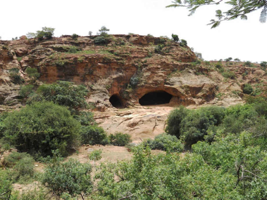
Photo 8.10 The kayeh be’ati, or red caves (2017). These caves may be natural cavities that have been expanded by herders for use as shelters (see Chap. 28), although whether or not they were excavated by humans (and if so, when) remains uncertain. They are located along an age-old communication line between the towns of Adwa and Mekelle, through the Ab’aro pass. The Italians built a road along this line during the 1930s which is now disused (Photo 38.29), but remnants of Italian buildings can still be seen on top of the small amba that holds the caves. Photo Jan Nyssen (2017)
Illustration from the identified source publication. Captions on the source page are preserved separately and are not asserted to belong to this individual crop. Publication year is not the image date.
Image rights
Original publication and credited image creators retain their rights. No open licence has been established for this corpus copy.
User-confirmed permission to use images in the local Habesha History corpus, 2026-09-28; this does not grant visitors a general reuse licence.
Request image removal