
Geo-trekking in Ethiopia's Tropical Mountains: The Dogu'a Tembien District — illustration 1, PDF page 217
Source record
- Source
- Habesha History book corpus — Geo-trekking in Ethiopia's Tropical Mountains: The Dogu'a Tembien District
- Book
- Geo-trekking in Ethiopia's Tropical Mountains: The Dogu'a Tembien District
- Source reference
- Geo-trekking in Ethiopia's Tropical Mountains: The Dogu'a Tembien District; PDF page 217; embedded illustration 1, exact source rectangle 56.52, 244.35, 363.08, 446.0
- Page
- 217
- Publication year
- 2019
- Type
- Book illustration
Date of image not recorded.
Creator not recorded.
Source-book and PDF-page attribution only. No place, subject, creator or image date is inferred from nearby body text or the publication date.
Source-page captions
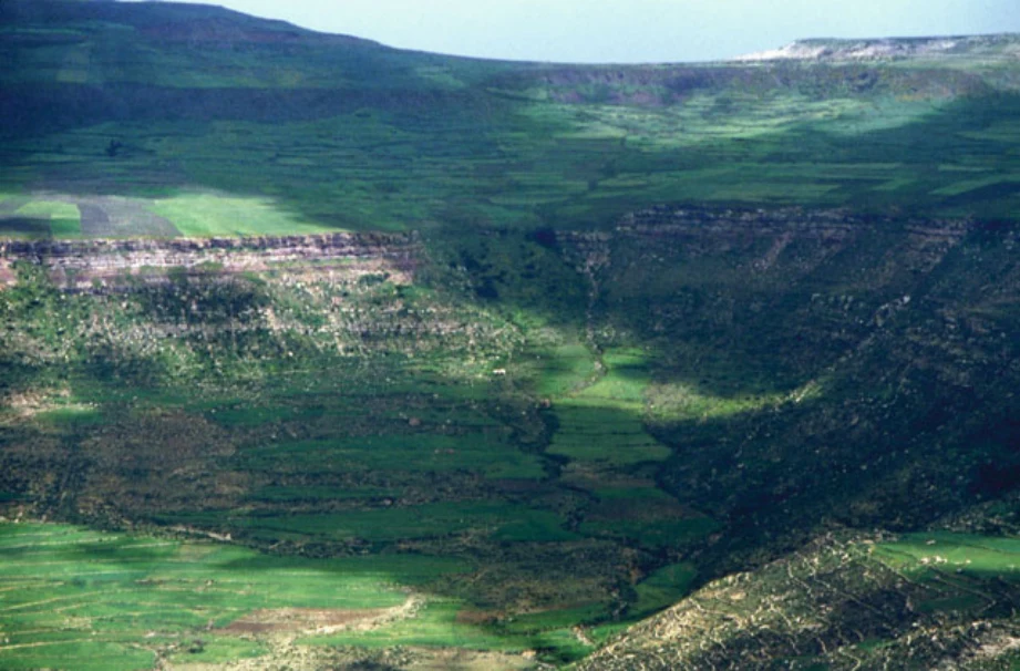
Photo 13.1 Bird’s eye view of the May Zegzeg catchment (or Zenaqo-Argak’a catchment), showing the lithological succession. Above the conspicuous reddish Amba Aradam Sandstone cliff that stretches across the photo, there is basalt, and right under the sandstone, within the same escarpment, Antalo Limestone is present. Dark green grasspea (Lathyrus sativus) crop evidences the perched water table that has built up in the colluvial mantle on top of the sandstone, as does a large tree nearby the May Ntebteb spring in the central part of the cliff. Photo Jean Poesen (September 2001)
Illustration from the identified source publication. Captions on the source page are preserved separately and are not asserted to belong to this individual crop. Publication year is not the image date.
Image rights
Original publication and credited image creators retain their rights. No open licence has been established for this corpus copy.
User-confirmed permission to use images in the local Habesha History corpus, 2026-09-28; this does not grant visitors a general reuse licence.
Request image removal