
Geo-trekking in Ethiopia's Tropical Mountains: The Dogu'a Tembien District — illustration 1, PDF page 258
Source record
- Source
- Habesha History book corpus — Geo-trekking in Ethiopia's Tropical Mountains: The Dogu'a Tembien District
- Book
- Geo-trekking in Ethiopia's Tropical Mountains: The Dogu'a Tembien District
- Source reference
- Geo-trekking in Ethiopia's Tropical Mountains: The Dogu'a Tembien District; PDF page 258; embedded illustration 1, exact source rectangle 56.69, 213.17, 363.13, 442.66
- Page
- 258
- Publication year
- 2019
- Type
- Book illustration
Date of image not recorded.
Creator not recorded.
Source-book and PDF-page attribution only. No place, subject, creator or image date is inferred from nearby body text or the publication date.
Source-page captions
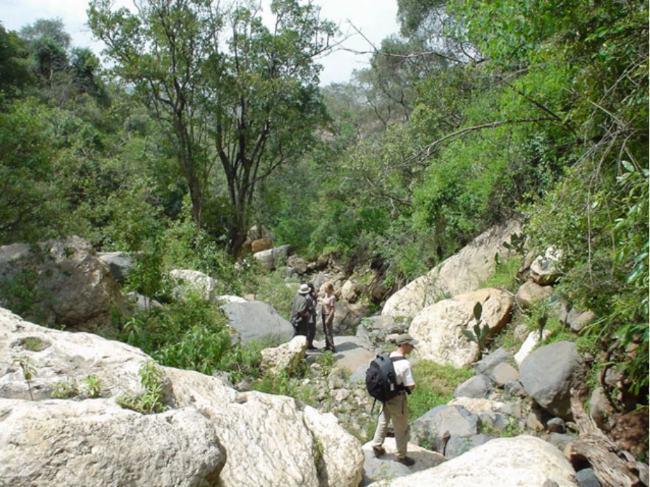
Photo 15.7 Interior of Abiy Dur forest near Waseya. The steep banks of ephemeral streams running through church forests are often covered by dense thickets of understorey trees and shrubs, and act as surrogate forest ‘core’ area for understory bird species and other forest specialists. Abiy Dur (49 ha) is large enough to have a proper forest core area in addition to these ephemeral river habitats. The stream running through the forest is an interesting route to explore the entire elevation gradient of the forest. The cacti on the right are Opuntia ficus- indica, an alien invasive species common in Dogu’a Tembien that is appreciated for its fruits, cactus-figs (beles in Tigrinya). Photo Raf Aerts (2003)
Illustration from the identified source publication. Captions on the source page are preserved separately and are not asserted to belong to this individual crop. Publication year is not the image date.
Image rights
Original publication and credited image creators retain their rights. No open licence has been established for this corpus copy.
User-confirmed permission to use images in the local Habesha History corpus, 2026-09-28; this does not grant visitors a general reuse licence.
Request image removal