
Geo-trekking in Ethiopia's Tropical Mountains: The Dogu'a Tembien District — illustration 1, PDF page 441
Source record
- Source
- Habesha History book corpus — Geo-trekking in Ethiopia's Tropical Mountains: The Dogu'a Tembien District
- Book
- Geo-trekking in Ethiopia's Tropical Mountains: The Dogu'a Tembien District
- Source reference
- Geo-trekking in Ethiopia's Tropical Mountains: The Dogu'a Tembien District; PDF page 441; embedded illustration 1, exact source rectangle 56.52, 62.36, 363.46, 224.39
- Page
- 441
- Publication year
- 2019
- Type
- Book illustration
Date of image not recorded.
Creator not recorded.
Source-book and PDF-page attribution only. No place, subject, creator or image date is inferred from nearby body text or the publication date.
Source-page captions
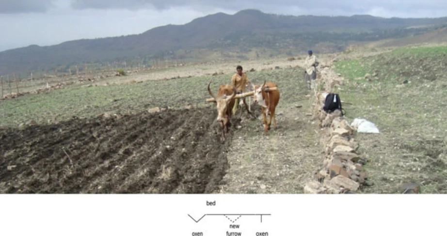
Photo 29.3 The derdero+ system involves shaping of beds and furrows by a pair of draught animals with attached mahrasha (on a farmer’s field at May Zegzeg, July 2009). Only a single, broad-spaced tillage operation is needed. The farmer replaced one of the oxen in the span by a (weak) cow, as only the sediment accumulated in the previous year’s furrows needed to be reworked and less power was needed. Note how the left ox walks in the furrow, which provides guidance for the position of the plough tine in the immediately upslope furrow. After Nyssen et al. (2011)
Illustration from the identified source publication. Captions on the source page are preserved separately and are not asserted to belong to this individual crop. Publication year is not the image date.
Image rights
Original publication and credited image creators retain their rights. No open licence has been established for this corpus copy.
User-confirmed permission to use images in the local Habesha History corpus, 2026-09-28; this does not grant visitors a general reuse licence.
Request image removal