
Geo-trekking in Ethiopia's Tropical Mountains: The Dogu'a Tembien District — illustration 1, PDF page 468
Source record
- Source
- Habesha History book corpus — Geo-trekking in Ethiopia's Tropical Mountains: The Dogu'a Tembien District
- Book
- Geo-trekking in Ethiopia's Tropical Mountains: The Dogu'a Tembien District
- Source reference
- Geo-trekking in Ethiopia's Tropical Mountains: The Dogu'a Tembien District; PDF page 468; embedded illustration 1, exact source rectangle 56.01, 59.53, 363.52, 253.64
- Page
- 468
- Publication year
- 2019
- Type
- Book illustration
Date of image not recorded.
Creator not recorded.
Source-book and PDF-page attribution only. No place, subject, creator or image date is inferred from nearby body text or the publication date.
Source-page captions
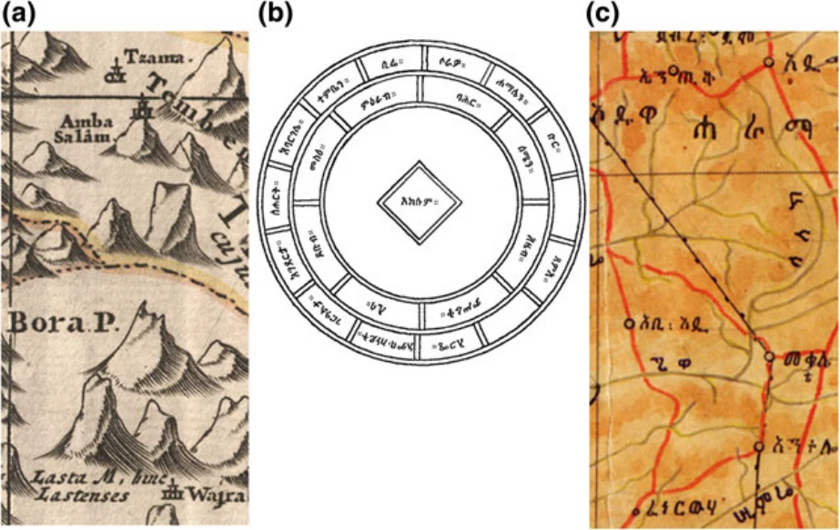
Fig. 31.2 Dogu’a Tembien and its surroundings as it appears on maps with strong indigenous input: a Ludolf and Gorgoryos (1683) with the wordings Temb[i]en clearly written on the highland (Dogu’a) part and striking Amba Salam as a building on top of a mountain, referring to the Dabba Selama monastery; b 18th C. manuscript chart with Aksum as centre and Temb[i]en as one of the northern Ethiopian provinces (Lusini 2005); and c the 1923 map prepared by Armenian refugee Kh. B. Papazian for the Ethiopian emperor, showing among others Abiy Addi, Giwa (=Giba R.), Suluh R., as well as mule track and telegraph line linking Mekelle and Adwa across Dogu’a Tembien. After https://ethiomap.huma-num.fr/
Illustration from the identified source publication. Captions on the source page are preserved separately and are not asserted to belong to this individual crop. Publication year is not the image date.
Image rights
Original publication and credited image creators retain their rights. No open licence has been established for this corpus copy.
User-confirmed permission to use images in the local Habesha History corpus, 2026-09-28; this does not grant visitors a general reuse licence.
Request image removal