
Geo-trekking in Ethiopia's Tropical Mountains: The Dogu'a Tembien District — illustration 1, PDF page 479
Source record
- Source
- Habesha History book corpus — Geo-trekking in Ethiopia's Tropical Mountains: The Dogu'a Tembien District
- Book
- Geo-trekking in Ethiopia's Tropical Mountains: The Dogu'a Tembien District
- Source reference
- Geo-trekking in Ethiopia's Tropical Mountains: The Dogu'a Tembien District; PDF page 479; embedded illustration 1, exact source rectangle 56.52, 62.36, 363.08, 249.28
- Page
- 479
- Publication year
- 2019
- Type
- Book illustration
Date of image not recorded.
Creator not recorded.
Source-book and PDF-page attribution only. No place, subject, creator or image date is inferred from nearby body text or the publication date.
Source-page captions
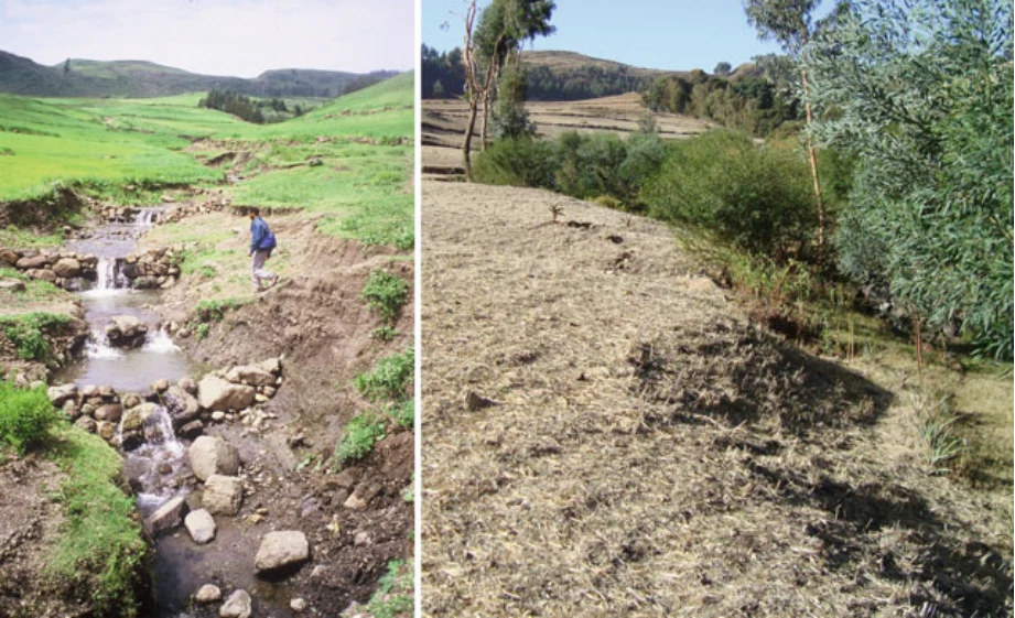
Photo 31.4 The May Zahla gully near Dingilet in August 1998 and revisited on 17/2/2010 (Photos Jan Nyssen). The nice base flow in this seasonal river can only be observed in August and September, just like the crop stand. Environmental changes consist of the revegetation of the gully, eucalypt growth at the back, and densification of SWC structures. To avoid obstruction by trees the repeat photographer’s viewpoint has been slightly moved to the left
Illustration from the identified source publication. Captions on the source page are preserved separately and are not asserted to belong to this individual crop. Publication year is not the image date.
Image rights
Original publication and credited image creators retain their rights. No open licence has been established for this corpus copy.
User-confirmed permission to use images in the local Habesha History corpus, 2026-09-28; this does not grant visitors a general reuse licence.
Request image removal